At one point in their life, everyone dreams of climbing Mount Everest, or at least ponders how beautiful the view from the top of the world must be. To reach the top of the tallest mountain in the world and know that you are higher than anyone else on earth, even if it is only for the briefest of moments, is certainly amongst the most amazing of human feats. After reading Jon Krakaur’s novel Into Thin Air, I was both amazed by this climb and humbled by the fact that not everyone makes it off the mountain alive. Sadly, the fact that the story turned fatal shook and shattered my dream a bit, and I think fear won out after finishing the book as I no longer have the desire to stand on top of the world. Instead, I have settled on seeing and experiencing the mountain from the base camp from where those brave climbers willing to risk their lives to conquer Everest begin the accent.
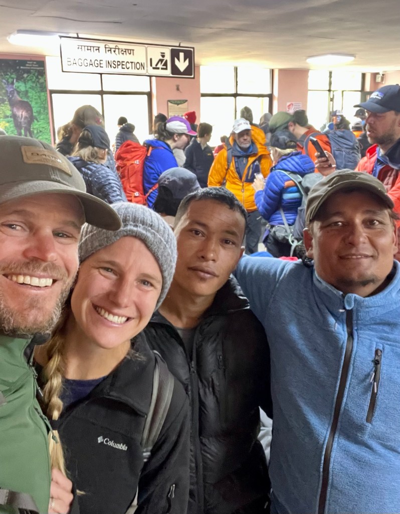
Upon arriving on a bus to the capital city of Kathmandu, we checked into our hotel and met up with the owner of our trekking company Breakfree Adventure. This is the same company that Nate used when he trekked to Everest Base Camp back in 2017. We worked out the remaining logistics and rented two sleeping bags and warm down jackets for our trek. We were given large waterproof duffel bags to fill with our gear that would be carried by our porter. We spent our final night in Kathmandu before flying up into the Himalayas wandering around the Thamel tourist district, grabbing last-minute food items, and eating at an amazing mom-and-pop restaurant called the Western Tandoori and Naan House.

The following morning we were feeling lucky because we did not need to take a shuttle bus at 2am like many tourists to a different airport to catch a flight into the mountain village of Lukla. Additionally, due to poor weather the day prior the originally scheduled flight of 7am was pushed back to 9am, so we even had time for a nice breakfast. When our tour company and driver arrived to pick us up from the hotel we found out that our flight had been canceled for the morning, but we would instead be flying up to Lukla on a helicopter! We were so excited! We were taken to the airport, passed around to a couple of different staff, and then told to wait. Unfortunately, due to weather delays, we had to wait around for nearly four hours for our helicopter and we started to get worried because afternoon weather frequently comes in cancelling all flights up to Lukla for the rest of the day.
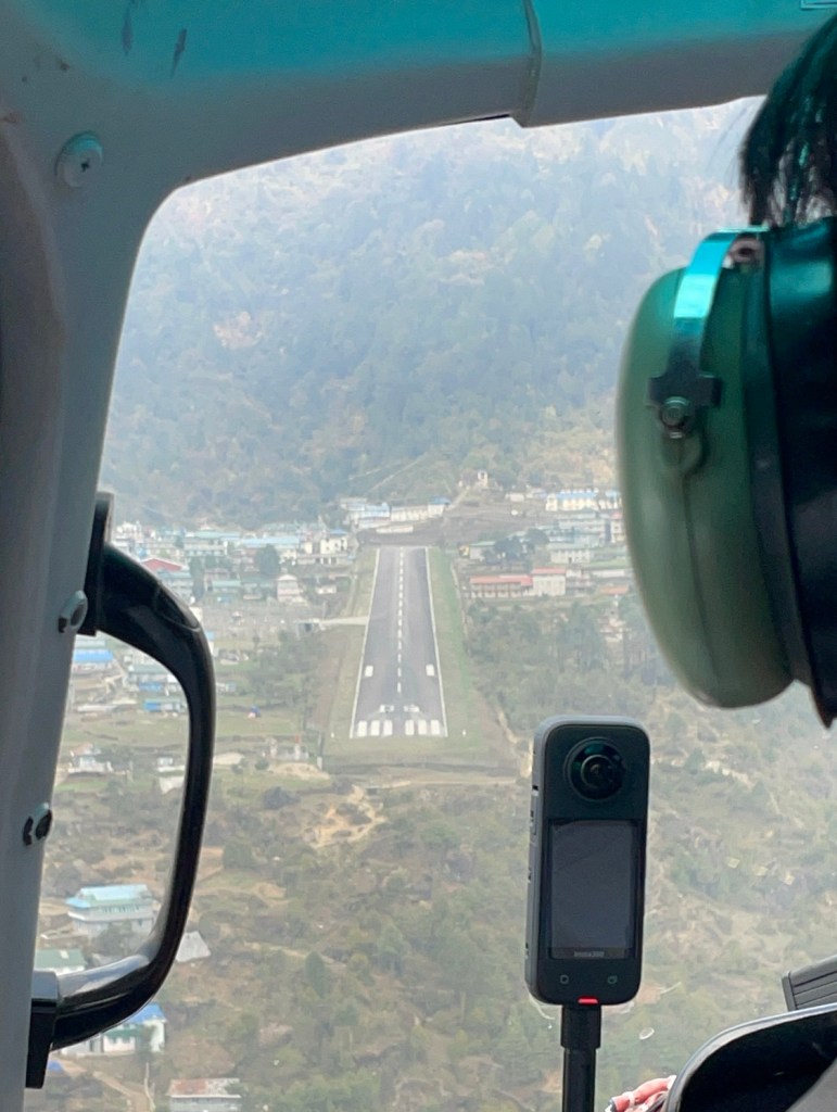

Finally, our time arrived and we were driven in a small van to the helicopter pad where we loaded up and embarked on our journey! We of course took many pictures and videos to capture the views and commemorate this spectacular ride. Taking off in a helicopter is a completely different experience than a plane. You just rise off the ground and hover. I was also surprised that at times the helicopter felt very wiggly rocking back and forth similar to a boat, which made me quite nervous. Without question, the flight was beautiful and exciting, but the amount of smog over Nepal this spring was sad to see. There were times when it felt like we were flying blind because the smog was so thick. Landing in the village of Lukla is a crazy experience since there is literally an airport runway hanging on the side of a Himalayan mountain. A helicopter landing is not a problem, but with this incredibly short ski jump-looking runway, I can imagine landing a plane is quite scary.


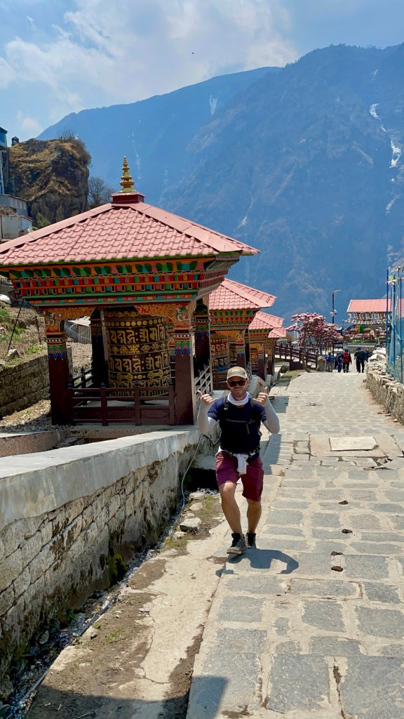
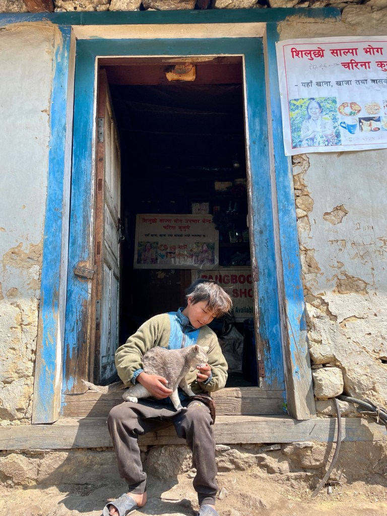
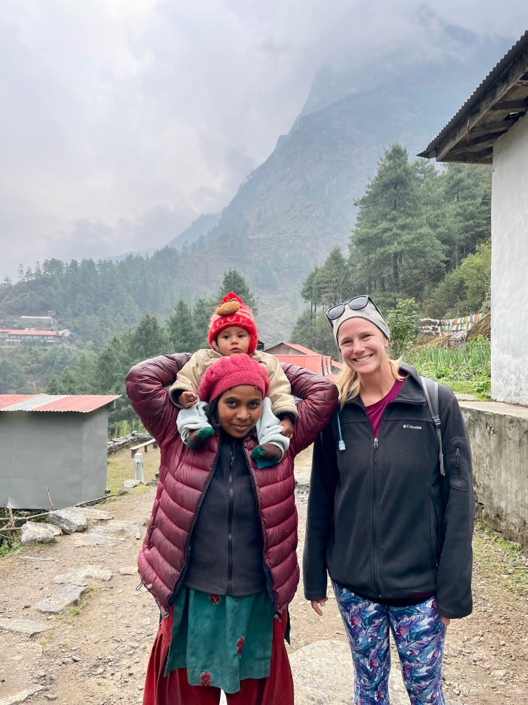
When we landed we met our guide for the trek Dipak and porter Santos. They are both from a village just a bit further down the mountain from Lukla, and both were super kind and helpful throughout our time in the Himalayas. While we climbed to Annapurna Base Camp on our own, Everest Base Camp and the Three Passes that we were going to summit were a much bigger endeavor, so we chose the safety of an expert guide and the assistance of a porter. Not hauling our own bags over the next fifteen days of hiking was an added bonus and literally a weight off our shoulders. The hike leaving Lukla on that first afternoon was very easy, and we covered the planned 9km in a matter of just over two hours. We hiked through many small villages and along the beautiful blue ‘Milk’ river. We took that afternoon to get to know our guide and get our trekking legs under us once again. We spent the night in the small village of Toc Toc at the Himalayan Hotel, which was really nice. We even had a view of the river from the window of our room.


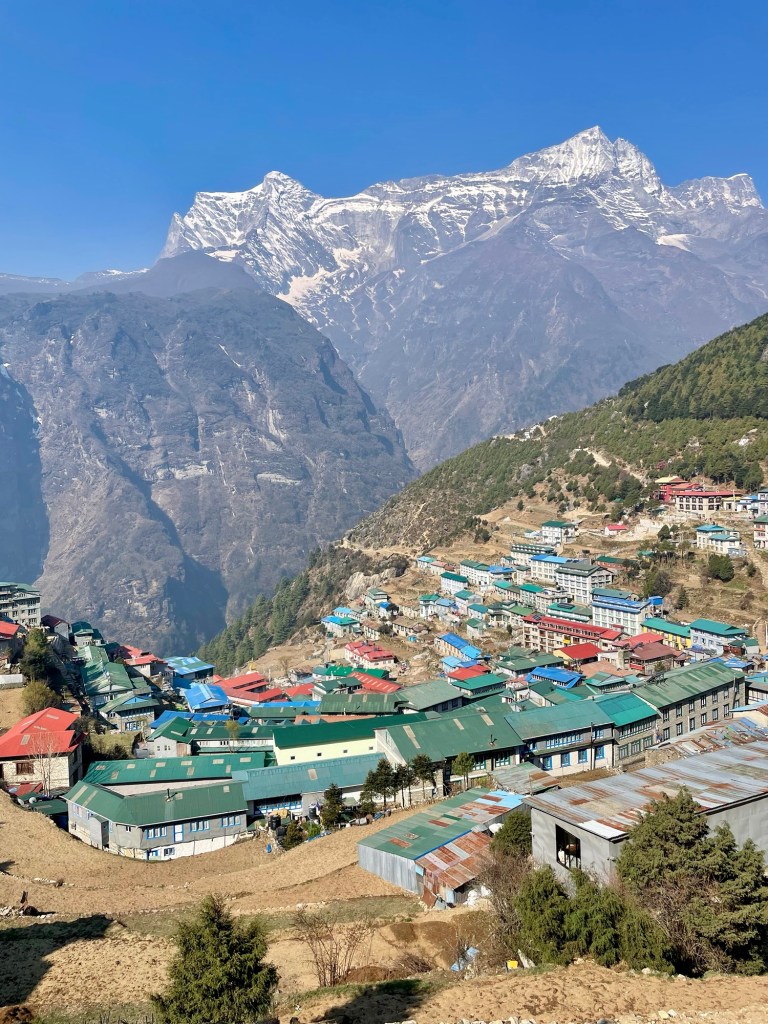
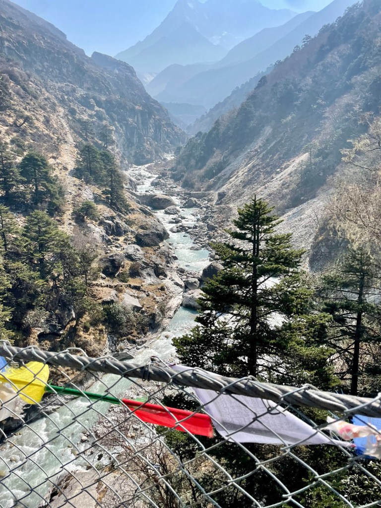
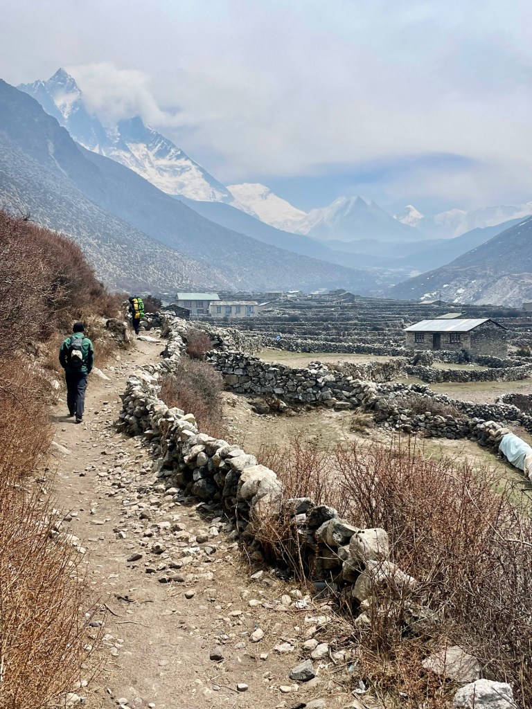
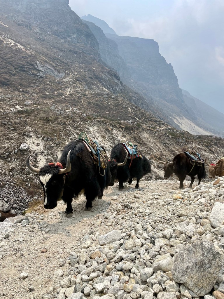
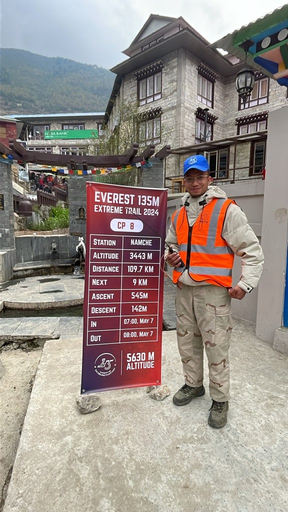
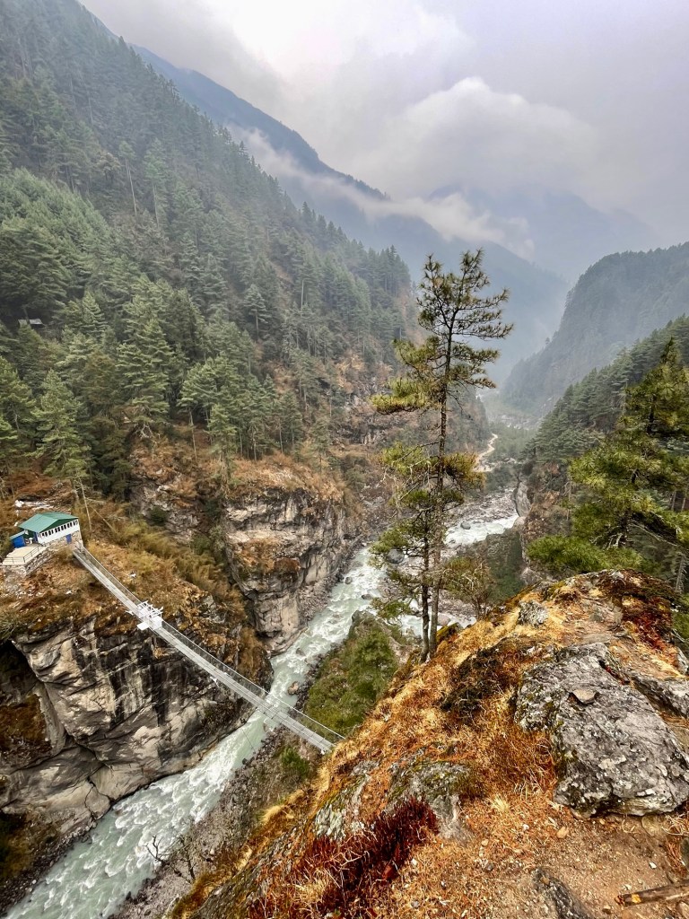
The following morning we woke up early to hit the trail. We would gain the most elevation today going up 800 meters over 9km. I was really looking forward to this hike because we were going to Namche Bazaar, which is the largest village in the region and Nate had said it had a really cool vibe. It is worth noting that there are no roads in this region and everything from food and water, to the supplies to build the villages themselves have been hauled in on the backs of porters, or the donkeys, horses, and yaks that work these trails. Most people stay in Namche for two days to acclimate to the altitude before moving on, but we were only going to do one night since we just hiked ABC and had already spent several nights sleeping at these altitudes. After hiking ABC with packs, Nate and I felt like we were flying up the mountain. Perhaps we hiked a little too fast since we kept leaving our guide Dipak behind. We enjoyed walking along the cliffs with the beautiful river now well below and crossing larger suspension bridges back and forth across the valley. The final push to Namche is quite steep, but we were rewarded with a nice coffee and carrot cake once we arrived in the village.


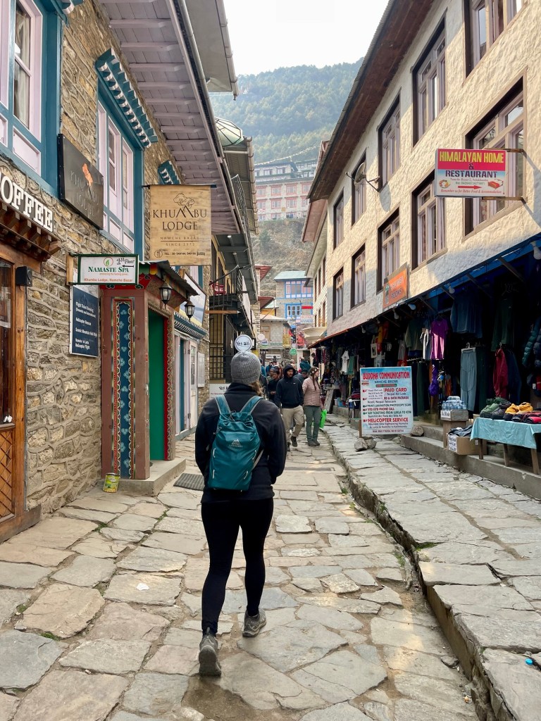
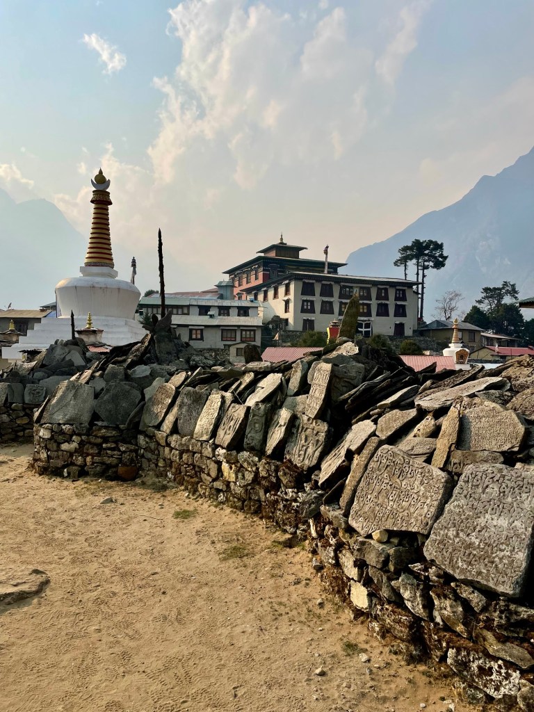
Namche Bazaar is in a valley with mountains on all sides and filled with hotels and little shops selling everything from hiking gear to Nepalese trinkets. There is a small coffee shop in town that shows a different Everest documentary every day at 3pm, and we enjoyed a really good one shot in the early 2000s by National Geographic highlighting Edmund Hillary’s son following in his father’s footsteps by making his own summit of Everest.
The following morning we departed our tea/guest house and hiked up to the top of the village where we made our first stop at a museum dedicated to Tenzing Norgay. Tenzing was the Nepalese Sherpa who partnered with Edmund Hillary to reach the top of Everest for the first time. In Western culture, the term Sherpa has come to mean mountain guide, but one thing I learned on this trip was that Sherpa actually is the name of the ethnic group of people that live in this region. Sherpa translates in Tibetan to people from the East. Hundreds of years ago they hiked over the mountains from Tibet and settled in this region in what is now Nepal living off the land as farmers and herders. The fact that they live at such extremely high altitudes has helped them become world-renowned porters and mountain guides. With the increased popularity of high mountain climbing over the past hundred years, the higher the Sherpas go up in the Himalayas, the more they are paid. The demand for their high mountain knowledge and strength continues to grow, and with it, more sherpas put their lives at risk due to the great pay that comes with these 8000-meter expeditions. The Sherpa people have the most dangerous responsibilities in high mountain climbing, and subsequently, hundreds have died in avalanches, setting rope and guiding climbers on Everest over the past seventy years.

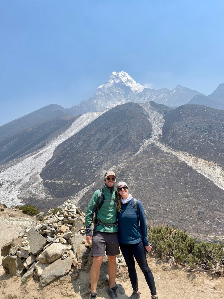
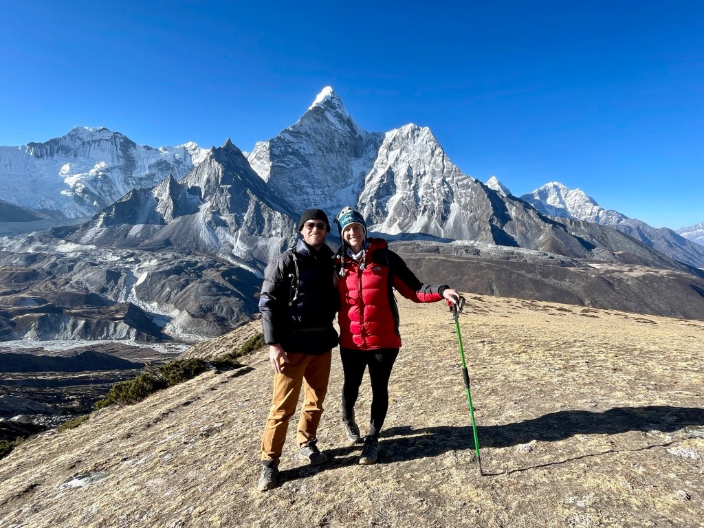
From the museum, I was awarded with my first look at Everest in the distance, which was really exciting! From here, we hiked gradually up the mountain and again hiked along a cliff that paralleled the river. We continued this until we came to a beautiful cafe with a lookout over the most daunting mountain Ama Dablam. This mountain is truly one of the most spectacular in the region and extremely difficult and technical to climb, but standing at just under 7000 meters this mountain doesn’t get the recognition it deserves because it is surrounded by four 8000 meter peaks in this Khumbu region of Nepal.


From here, we hiked down to cross the river in the valley below, which is always hard when you know you have to come right back up the other side. We ate lunch at the bottom of the valley to fuel up for the 500-meter climb back up to reach the monastic village of Tengboche at 3800 meters. Tengboche is known for a big monastery on the hill that performs ceremonies and chanting every day and is often the site of cremations and services for sherpas who die on the mountain. The monastery is Tibetan Buddhist and it was immaculately decorated. We were able to sit in while the monks chanted during their afternoon prayer rituals, and then we were blessed by a monk and given a red string necklace for our journey up higher into the Himalayas.

The following morning we gradually worked our way back down to the river passing another monastery just a few kilometers past Tengboche. We also found a surprise coffee shop called the Everest Bakery Cafe in Pangboche and ceremoniously had to stop in for two cappuccinos and some chocolate bread! They even had free charging and WiFi which was a bonus. Both of these, as well as hot showers, are luxuries that almost always come with a steep price above Namche Bazaar. After a short coffee break,k we continued down until we crossed a small bridge, then gradually worked our way up again. We had a 400-meter climb ahead of us, but luckily lunch in Shomare would give us a bit of a break. At the end of this day’s climb, we encountered a group of yaks with their minders, and we pitched in and did our best to help herd and keep the yaks on the trail for the last few kilometers. I find yaks to be really cute!
That evening we stayed in the village of Dingboche, which hosts 360 views of the mountains and sits at nearly the base of Ama Dablam. It was sunny the afternoon that we arrived, so we tried to do some laundry out back with the hose and even used the hose and fresh water to “shower” ourselves a bit since we hadn’t had a shower in several days. Despite the freezing water I even washed my hair. Then, we quickly escaped back inside to our sleeping bags and blankets to warm up. I was worried that I would start to feel the altitude since we were now going to be sleeping at 4400 meters (14,000 feet) and altitude sickness tends to hit worst at night, but to my surprise I was fine. I chose to take high altitude sickness medicine, and the pills really seemed to be helping. The high altitude medicine is super common in Nepal and I really recommend this option to anyone who is nervous about trekking at high altitudes in Nepal.

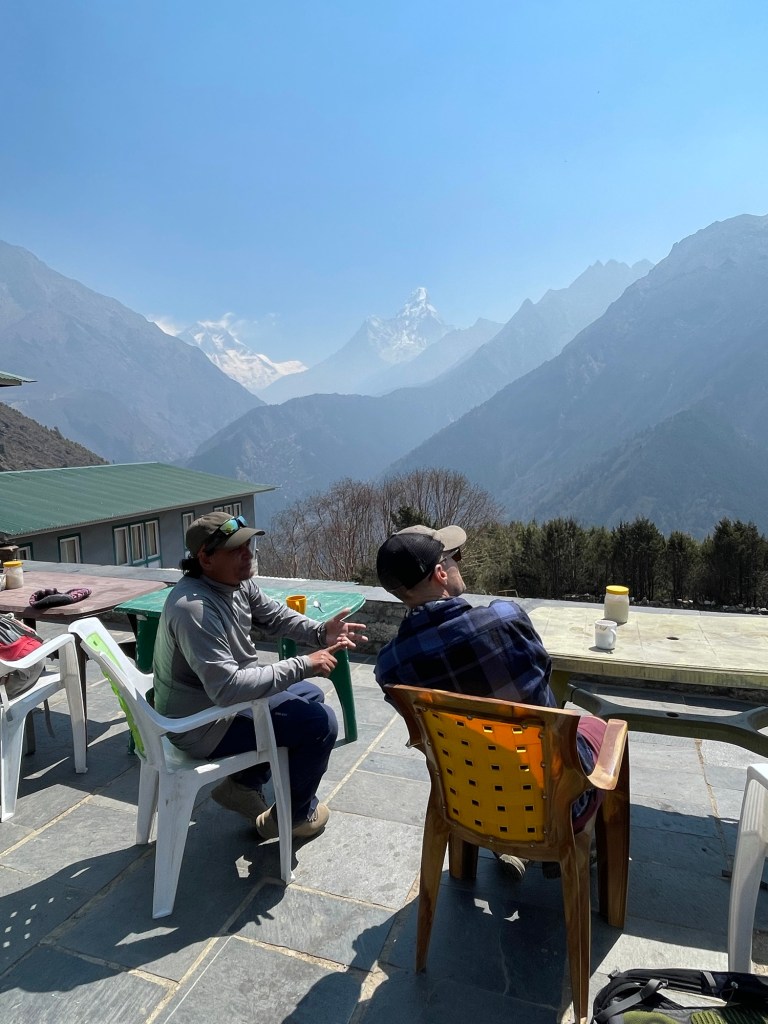
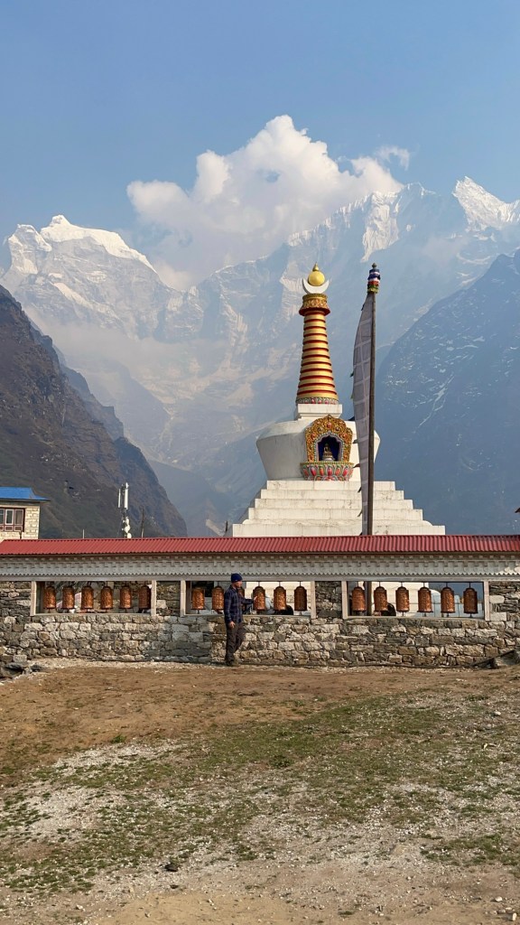
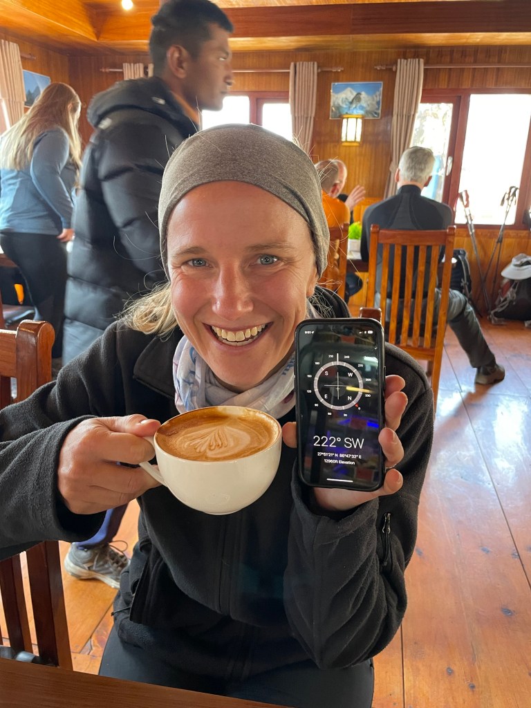
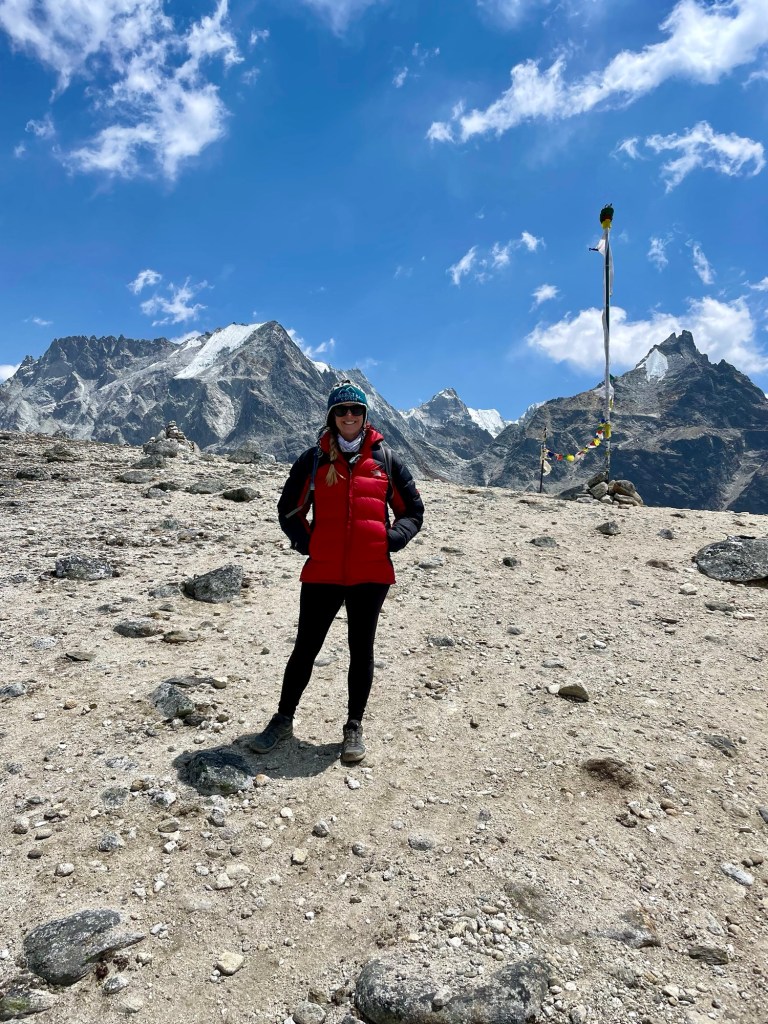
The following morning we were able to have a really lazy morning since we only had a two-hour hike ahead of us. The normal Everest Base Camp route would have taken us to a village called Pengboche, but since we were summiting the Three Passes our route took us further east to set us up for our first pass the following morning. After a short trek, we would have an opportunity to acclimatize a bit in the village of Chukhung, which is only 200 meters higher than the night prior. Acclimatization is critical at these heights and it was very much needed before really reaching for higher elevations on our first high mountain pass. With this short trek and rest day upon us, we found Cafe Himalaya before departing Dingboche and enjoyed a cappuccino and some blog time before making the quick trip to Chukhung. Cafe Himalaya is filled with memorabilia and signed photos from many Everest expeditions including a cup used and signed by Hilary. It is a great little bakery and coffee shop with free mobile charging for patrons that we highly recommend!


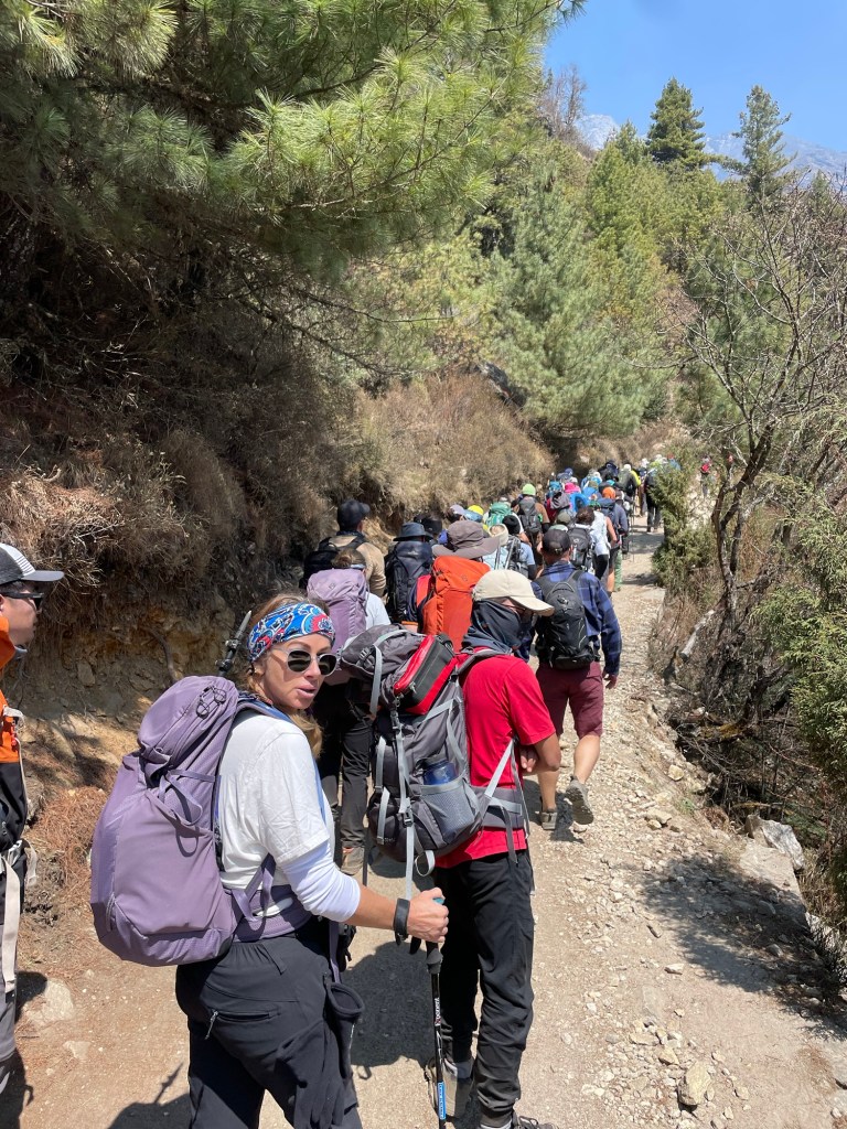
We headed out around midday and walked through a gorgeous valley with mountains on all sides. Everywhere I looked I saw gigantic snow-capped peaks and glaciers. It was my favorite day so far on the trek. An added bonus is that there wasn’t much traffic since most people went north on the more popular EBC route. We took our time to fully enjoy the stunning scenery. Nate even volunteered to take our porter’s giant pack, however he lasted a meager 200 meters before needing to set it down. The porters in the Himalayas are remarkably strong and carry their loads with a strap over their heads! We arrived in Chukhung around lunchtime and had the rest of the day to chill and get ready for our first pass the following day.

The following morning we had a 5:00am alarm since we needed to ensure we summited Kongma La pass before any bad weather potentially rolled in. The hike up was going to be very difficult since we were beginning our ascent at 4900 meters and would hike up to 5550 meters. This would be the highest of the 3 passes and higher than Everest base Camp. I had never reached these elevations in my life, and I was very intimidated by the prospect. We are quite fast climbers, but at high altitudes, you have to hike very slow because a small quick burst or a steep hill makes you feel like you just ran a sprint. Despite our slow pace, in many ways, it felt as if we were on an endless sprint up the mountain. The saving grace was the scenery, which was unreal.
We gained elevation quickly and were able to look back at the range of mountains behind us with the mighty Ama Dablum stealing the show. As we climbed higher, we started to pass mountain lakes and countless glaciers falling off the passes ahead. The final push to the crest of the pass was steep and very hard on the lungs, but I was so proud of myself. We had made it to the top of Kongma La Pass at 5,550 meters (18,200 ft). The view from both sides was breathtaking and we hung out at the top of the pass for about thirty minutes before heading down the other side.
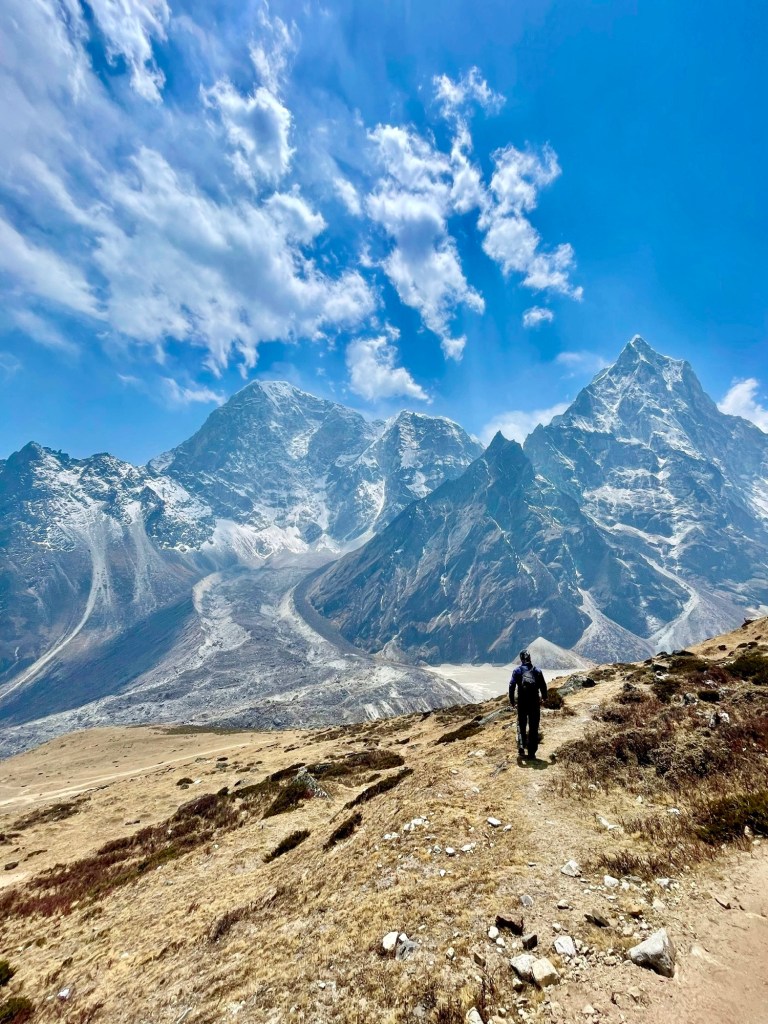
The descent was harder for me because altitude sickness was setting in, or perhaps just dehydration and the effects of the strong winds had brought on a horrible headache, which unfortunately lasted the rest of the day. As we traversed down the steep rock scree we were rewarded in the valley below with our first views of the famous Khumbu glacier that runs straight off the south face of Mt. Everest.

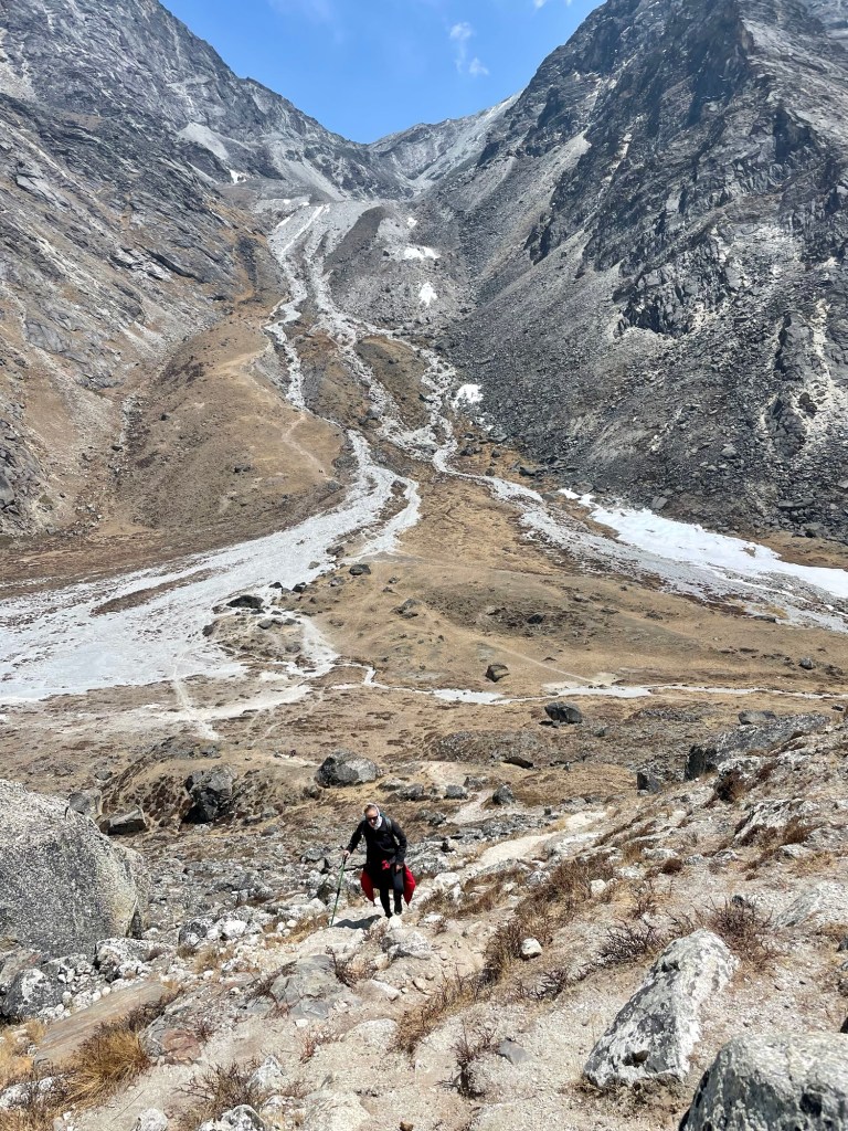
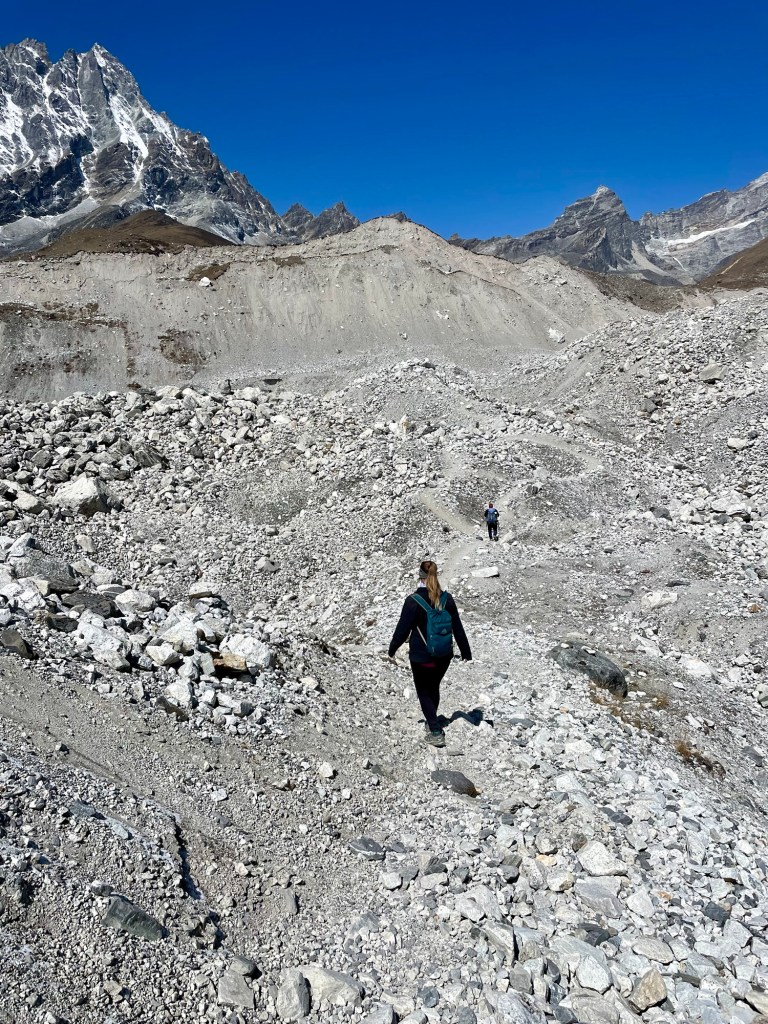
Our last task of the day was crossing this nearly kilometer-wide glacier. While huge amounts of ice were beneath us, the exposed part of the glacier is mainly just mounds of rock and stone that had been pulled off Mt. Everest many thousands of years ago. Glaciers are ever-changing due to the weather and other variables, therefore the direct route across the glacier wasn’t possible. Therefore, we needed to hike down always parallel to the glacier before we could climb across safely. While you might think that glaciers are flat, they are not. We had to consistently ascend and descend twenty to thirty-meter mounds of rock to make it to the other side. By the time we reached the town of Lobuche, I was completely exhausted and headed straight to bed.
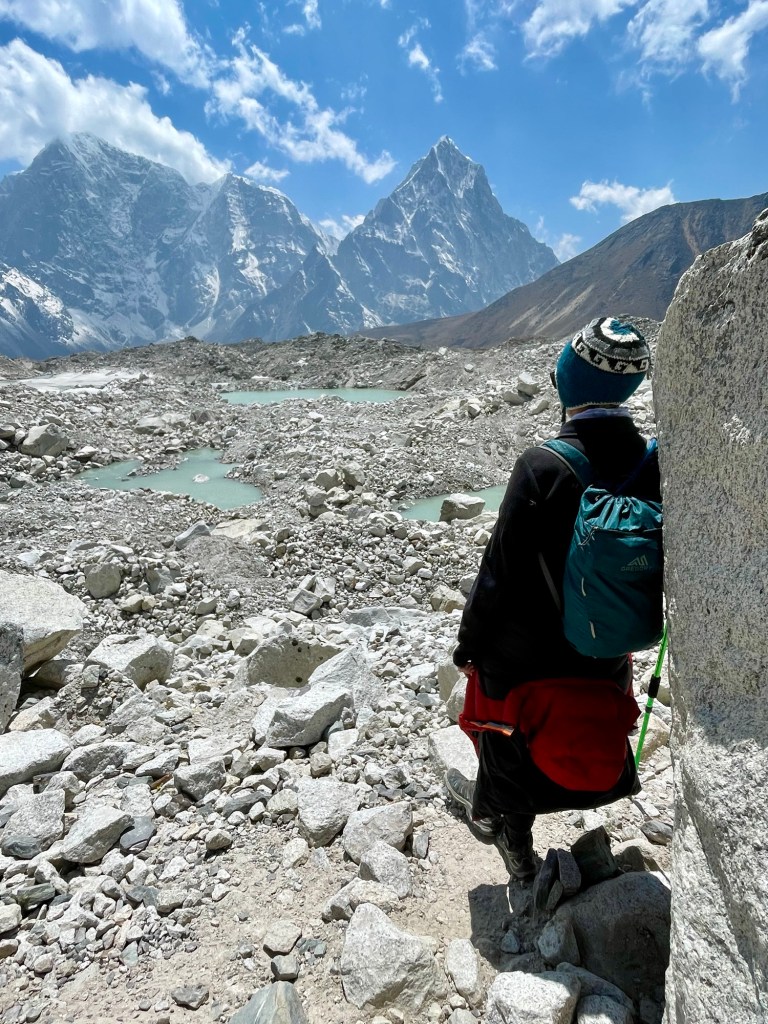


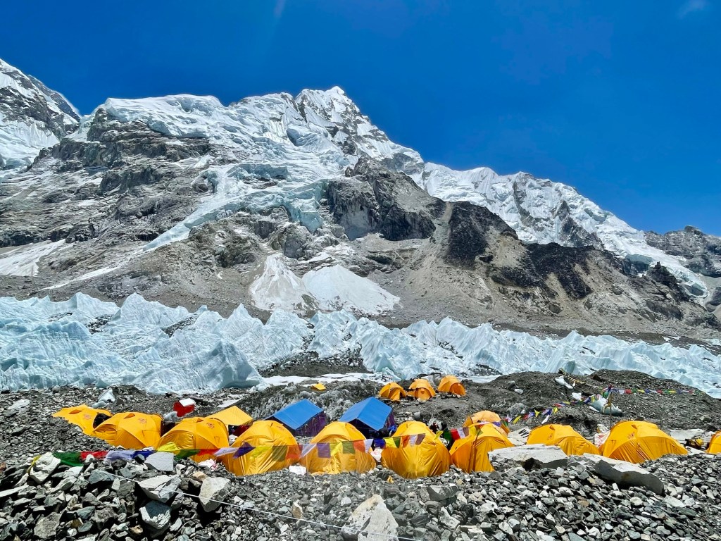
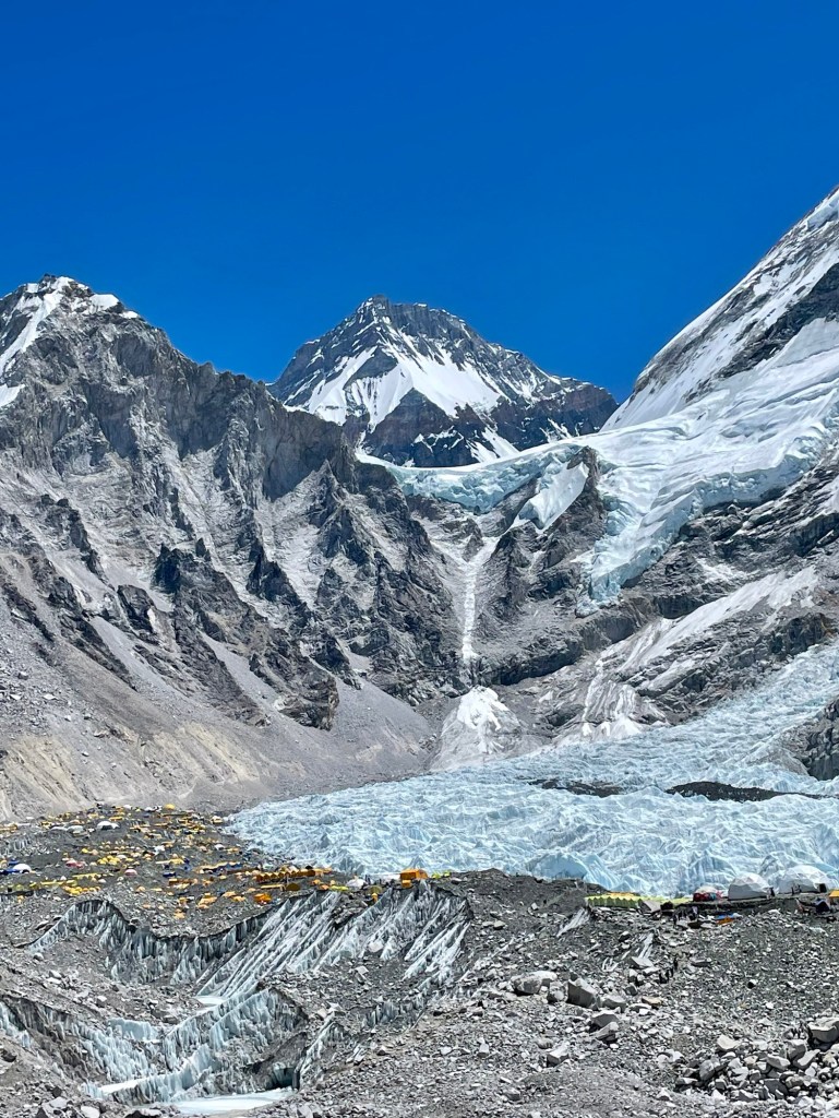
The following day was a momentous one as we were making the final push to Everest Base Camp. Once again we started really early in the morning to beat any potential weather and made our way to Gorakshep, the highest village in the world where we would be sleeping for the night. We checked in to our tea house, dropped our bags, and then continued our trek for the day up to Everest Base Camp to try to beat most of the other hikers as it can get very busy this time of year. When I first saw all the yellow tents on the Khumbu glacier in the distance, I was so excited. I had read and watched so many documentaries about Everest, and I was about to stand at the base of the tallest mountain in the world.
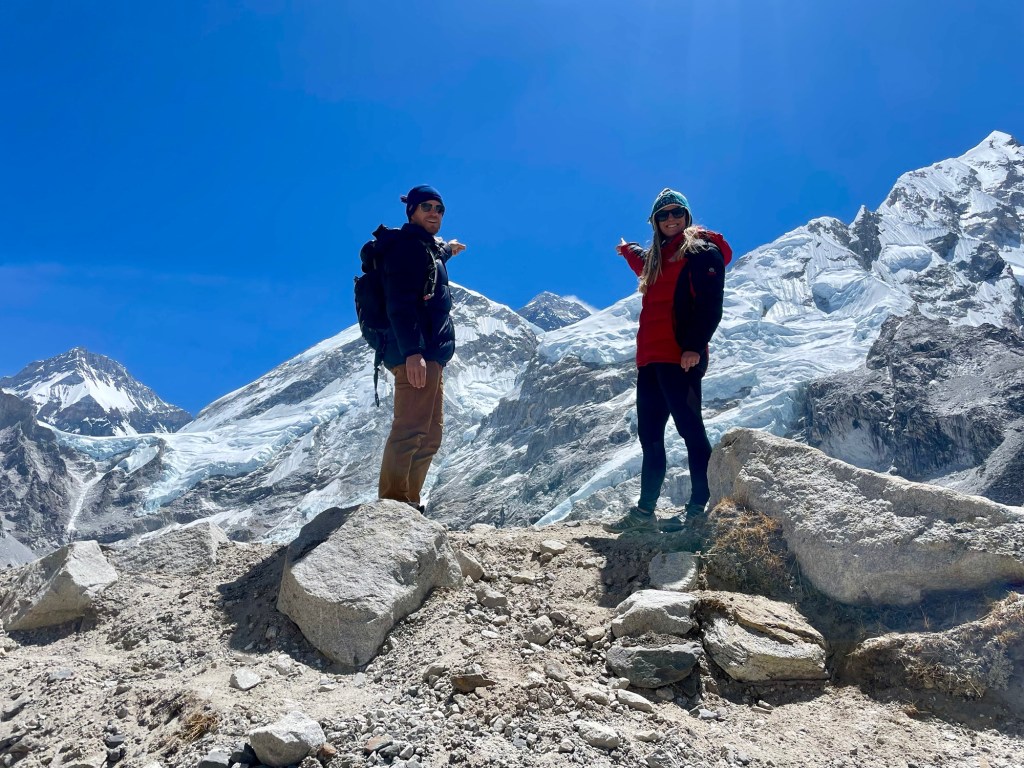

It was very interesting to be able to walk through base camp. Each company has built its own compound with tents, and mess hall, and various other large tents to hold all the gear needed for the expedition. They rope off their areas so that the general public cannot enter, but we were able to talk to summit climbers walking by. In the morning when the weather is still good helicopters fly into base camp about nearly every five minutes to unload gear and food, and to take other things down the mountain. The whole camp is a well-oiled machine and it felt great to be a part of it for a few hours that morning. It was also amazing to see the infamous Khumbu Icefall that has claimed the lives of many summit climbers as they make their way through the giant constantly shifting crevasses on their way to Camp One.
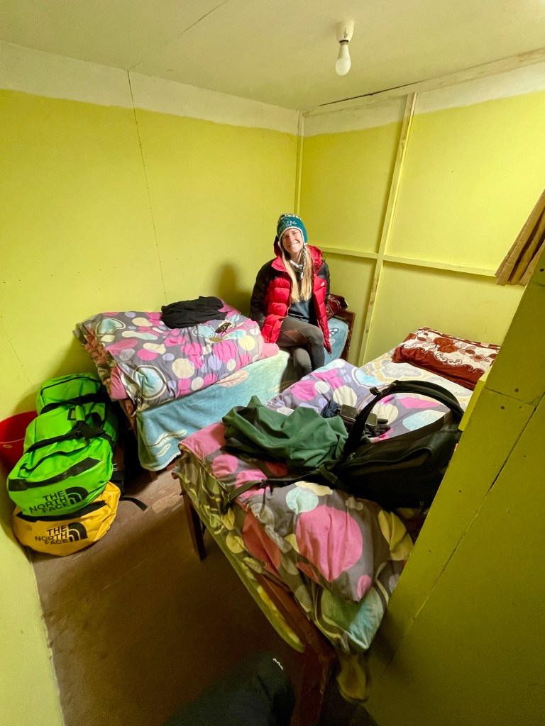
Once it became more crowded, we descended back to the village of Gorakshep, had some lunch, and just chilled the rest of the afternoon. These top two villages are much smaller than those lower down, which leads them to be really crowded during hiking season, and due to these extreme heights, the accommodations are less than stellar. Nate and I had a room that was about six feet by six feet with two single beds. It doesn’t leave a whole lot of room to move around and even inside it is extremely cold! Sleeping at 5,100 meters (16,700 feet) the altitude prevents almost everyone from getting a good night’s rest.
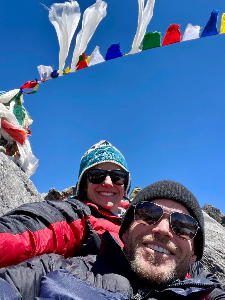
The following morning we once again woke up early to tackle Kalapatthar, which is a small mountain peak that towers over Gorekshep and provides an amazing sunrise view of Everest, base camp, and the entire Khumbu glacial valley. This return hike took us to the highest elevation of our entire trek at 5,643 meters (18,513 feet). The Sherpa people of the region refer to Everest as Chomolungma, meaning mother of the world. It is often referred to as the shy mountain because it is tucked in behind two other giant peaks, Nuptse and Lhotse, making it difficult to get a really good look at the tallest mountain in the world. In fact, you cannot even see the summit from base camp. This hike allowed us a remarkable view of both the summit of Everest, as well as the mountains in all directions. It was a slow and difficult 500-meter climb because of the altitude, steep rocky slope, and it was a bitterly cold morning. Once we reached the summit the views were so worth it!


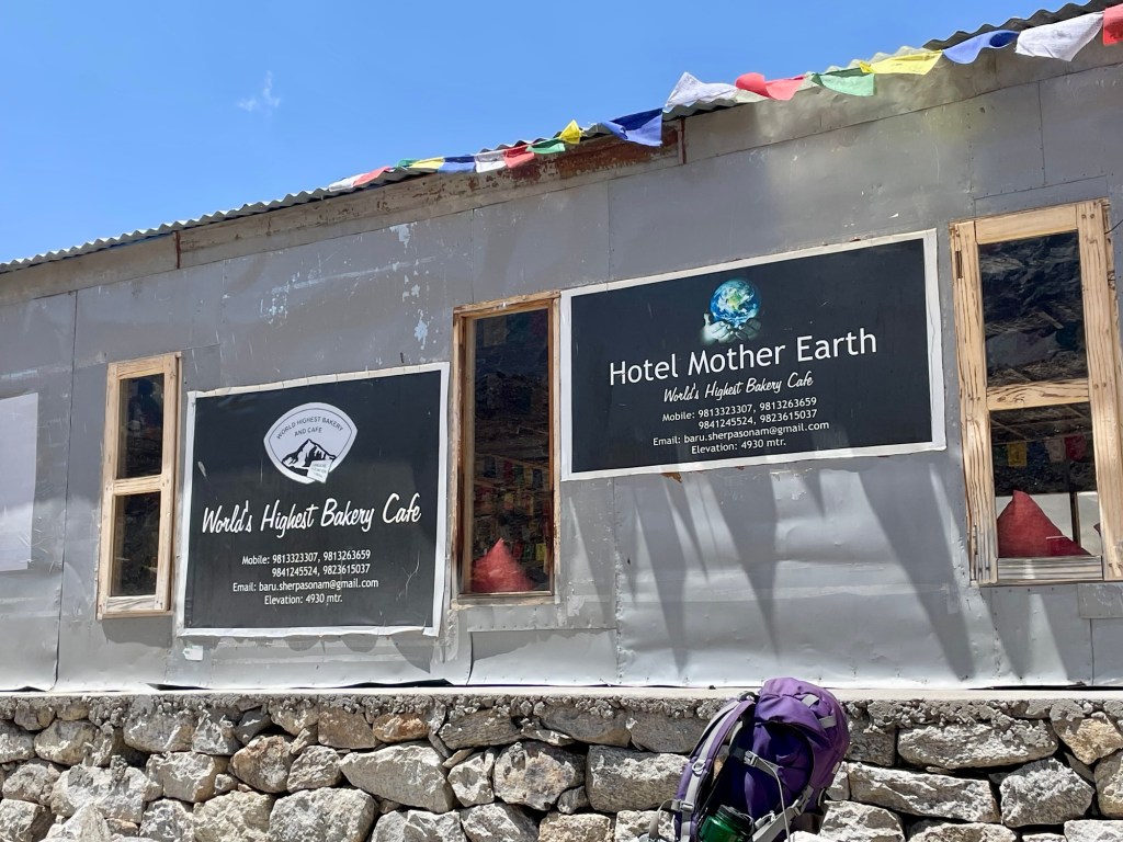
After climbing back down to Gorekshep, we had some breakfast and then started our way down the valley. At the start of our hike, we were hiking with the masses, which led to bottleneck points with hikers going in both directions as well as horses trying to get through. Unfortunately, the upper path along and through the glacier is only wide enough for one person. We tried to race around the masses on the rocks, but that was tough going. We arrived back in the village of Lobuche by mid-morning and decided to stop at the world’s highest cafe for a quick coffee. While it was expensive, the fact that a sherpa carried an espresso machine on his back up to 4,940 meters (16,207 feet) more than justified the $10, and it hit the spot after the early morning Kalapatthar summit.

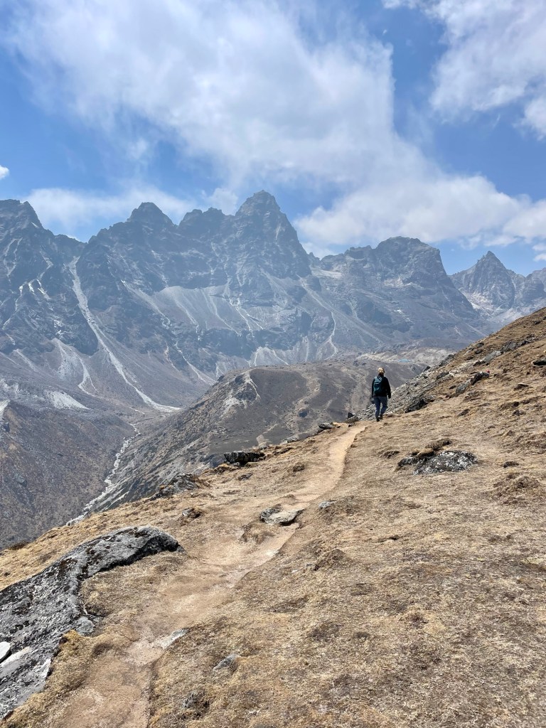
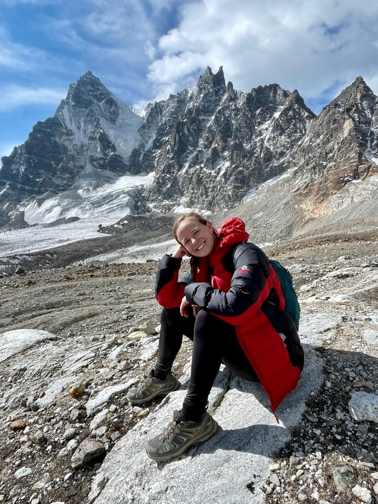
Just after descending down from Lobuche, we left the crowds behind and veered off the main EBC route as we started trekking our way deeper into the mountains. This is where the Three Passes trek once again separates off the main EBC trail. The views along this ridge line hike were absolutely stunning, and we were able to see all of the mountains and passes that we had conquered in the previous days. We turned the corner and found the spectacular Cholaste mountain towering over us with several giant glaciers winding their way off the peak and into the valley below. This mountain was truly spectacular and cast its shadow over us all the way to our destination for the evening in the tiny village of Dzongla.


The following morning we awoke early and for the fourth day in a row, we were going to climb to over 5,300 meters. We were on our way up our second of the three passes called Chola Pass. We first wound our way into a glacial valley and looked up at the mountains where I counted no less than six glaciers balancing precariously above us. It was a cold morning and all of the rivers were still frozen, as well as Nate’s drinking bladder.

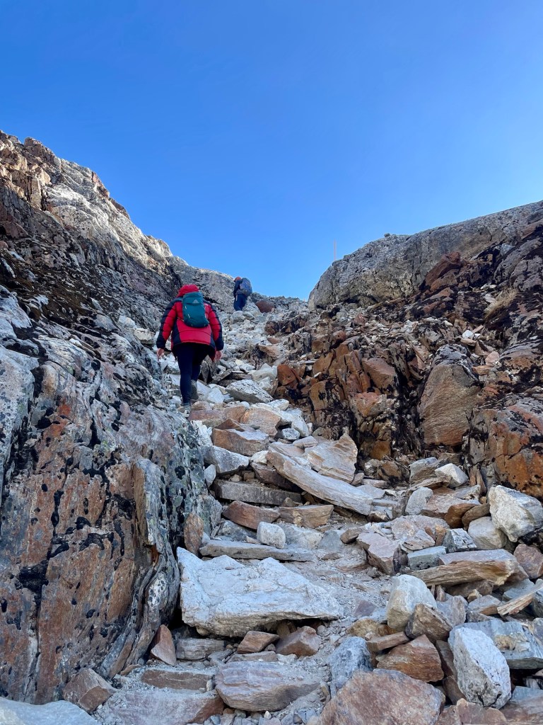
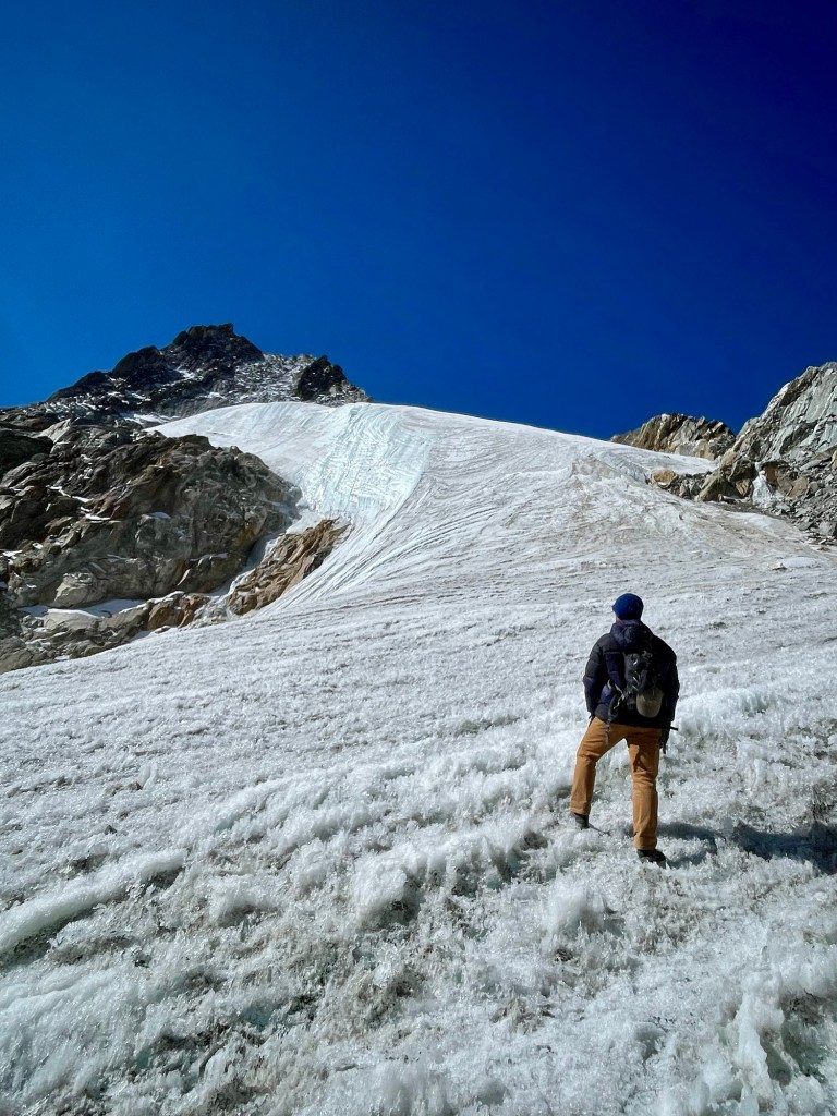
After scrambling up rocks for an hour we stood staring at a glacier that we would have to climb in order to reach the pass. Unlike the Khumbu Glacier where we mainly trekked across rocks, this glacier was just solid ice. It was slow going without crampons, but the views and the experience were worth it, as well as the views once we reached the top.


On the other side of the pass, we faced a steep descent. At this point, I was really tired and feeling a bit ill, so when I looked up and found out we had another 5,100-meter pass to climb over before our final descent, I was mentally beaten. Luckily, Nate is a great motivator! After our final pass, we had a long walk down through a valley to the village of Dragnag where we would be staying the night. Even though this town was still at a high elevation (4,700 meters), it felt easier to breathe compared to the previous three nights.


The following day was the easiest day we had in a long time. Our only task was a two-hour walk across another giant glacier to reach the village of Gokyo. We were able to enjoy a little bit of a sleep-in and enjoyed a slow, easy walk while taking in what is truly an out-of-this-world landscape.

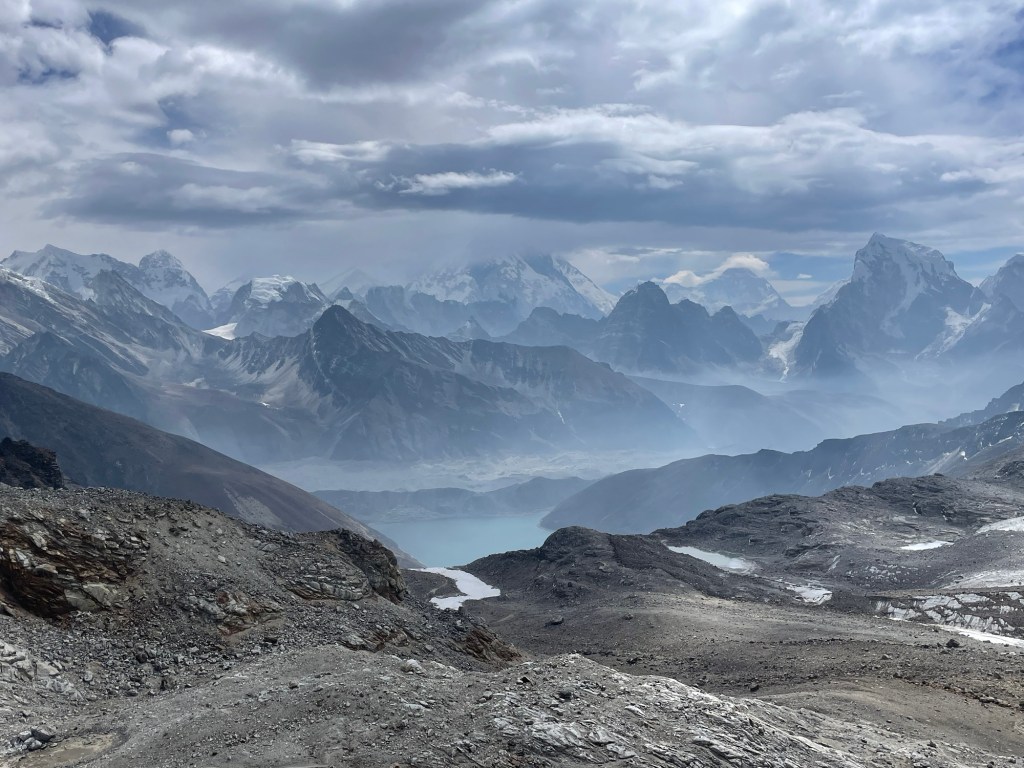
The Ngozumpa Glacier originates on Cho Oyu mountain which is the 6th largest mountain in the world sitting at 8,188 meters and was the fifth and final of the world’s fourteen 8,000-meter peaks that we saw during our trekking in Nepal. The Ngozumpa Glacier itself is one of the longest in Nepal at over 22 miles in length. This glacier crossing was similar to the Khumbu Glacial crossing where we were mainly walking across giant piles of rocks. Yet, we saw many large walls of ice and many small turquoise lakes full of crystal-clear water.


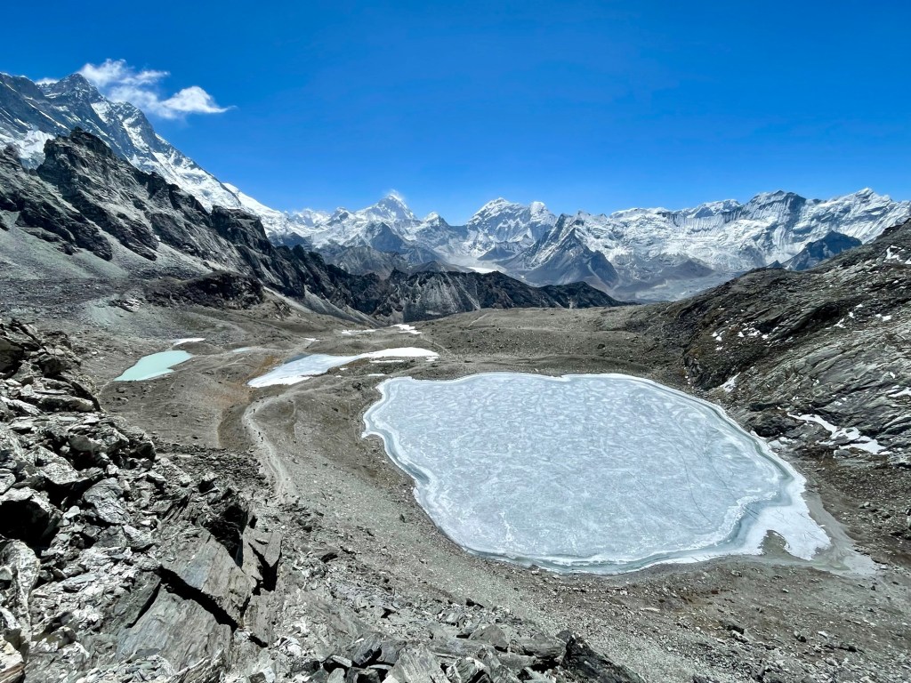
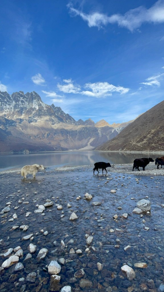
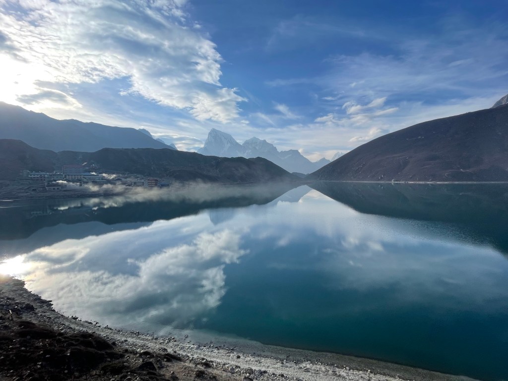
After exiting the glacier, which required a bit of scrambling up rock scree, we were finally able to see the Gokyo lakes which are considered amongst the highest alpine lakes in the world. They are filled with blue water, and our destination for the next two days was the cute village of Gokyo on the shore of one of the lakes. The dining room at our guesthouse had beautiful views over the lake at a small range of mountains that surround it. It was an amazing place for a two-day rest.

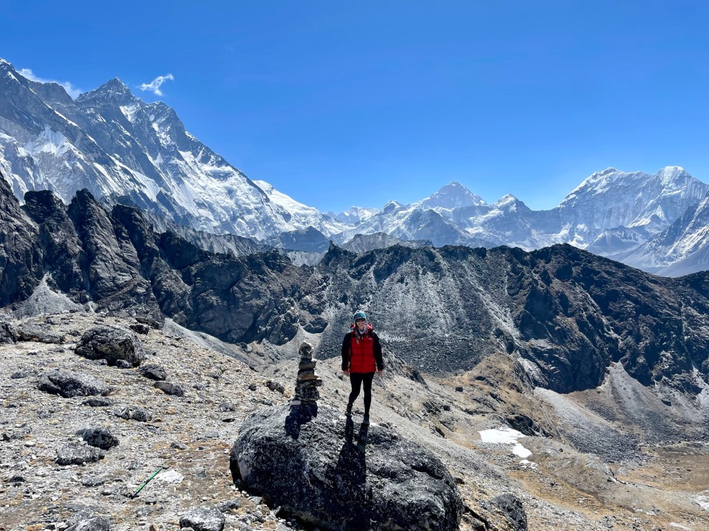
Unfortunately, Nate came down really sick at this stop. However, in a way, it was fortunate since he was able to just stay in the guesthouse for a full day of rest. I was able to read with an amazing view of the lake, and there was even a coffee shop that showed hiking documentaries. The following day, we were supposed to hike Gokyo Ri, which is a mountain right next to the town. Since Nate was sick, I went up by myself and had a lovely morning as I slowly made my way up the steep mountain and once again climbed to 5,300 meters.

I was very lucky with the weather and had a sunny blue sky day, which provided astounding views in all directions. This viewpoint is one of the best viewpoints on the Three Passes trek. On a clear day, you can see four 8,000+ meter peaks, the first (Everest), third (Lhotse), fifth (Makalu,) and sixth (Cho You) highest peaks in the world. You can also see the Gokyo lakes below and the entire Ngozumpa Glacier winding its way down the valley. It was truly breathtaking, and I just sat in awe taking it all in.


The following morning we were up early again for our third and final pass, Renjola Pass. Nate was still in quite bad shape and I now had a persistent cough as well, so it was slow going to get to the top of this 5,300-meter pass. The cough dubbed the Khumbu cough is a result of the cold, thin air that creates an infection in your lungs. It plagues most hikers in the region and in the evenings we would always hear a cacophony of coughs. We were giving it everything we had to reach over 5,300 meters for the sixth time this trip, and the impact of sleeping about 4,700 meters for the past eight nights was certainly taking a toll on both of us. We were worn down and our bodies were giving out a bit, but we were determined to finish this third and final pass.
This was the first day where we did not have a blue sky morning. The sky was a little hazy and cloudy. When we reached the top, the viewpoint was spectacular, but Everest quickly disappeared behind a cloud to shyly hide from us one last time. Looking out on the other side of the pass, we saw another set of snow-tipped mountains that reminded me of looking at the Rocky Mountains from Denver. Nestled just below the 5,300-meter summit in the valley below was another blue alpine lake that we are convinced should be recognized as the highest lake in the world. We also met some cute bird friends at the top who really wanted to share our snacks.

We hiked down the steep slope on the other side of the pass to the alpine lake. Looking back up to where we came from we are reminded one last time of the ruggedness of these mountain passes. While the rest of the day was long, since we still had another seven kilometers to hike, it was thankfully all downhill. I knew that Nate was really struggling and had no energy, so thankfully we just kept moving and arrived at the village of Lungdhen by lunchtime where we quickly crashed out in our teahouse room for the rest of the afternoon.

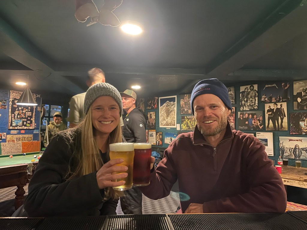
The following morning Nate seemed to rebound and was feeling a bit better. With the weather deteriorating over the past day we made the decision that we were ready to move quickly and reach lower altitudes where the thicker air would help both of us recover. We combined two days of hiking into one and were able to get back down to the largest Sherpa village of the region Namche Bazaar where we knew that a hot shower, cell phone service, and a Guinness at the highest Irish Pub in the world was exactly what two tired amateur high mountain trekkers needed. This speed-up meant that we had eighteen kilometers to cover, which is a lot for one day at these altitudes, but thankfully it was mostly all downhill. There was fresh snowfall above us, and we dealt with light rain and fog throughout the day. Combined with the smog that filled the lower valleys, our clear views of the Himalayas were now restricted at best.


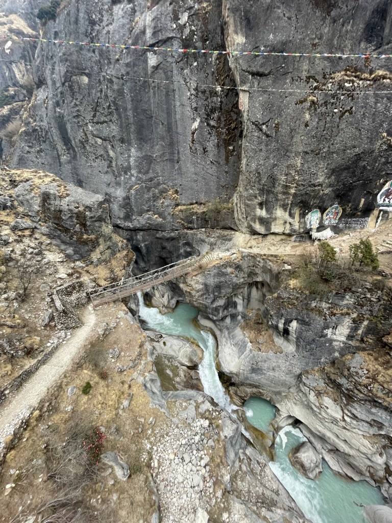
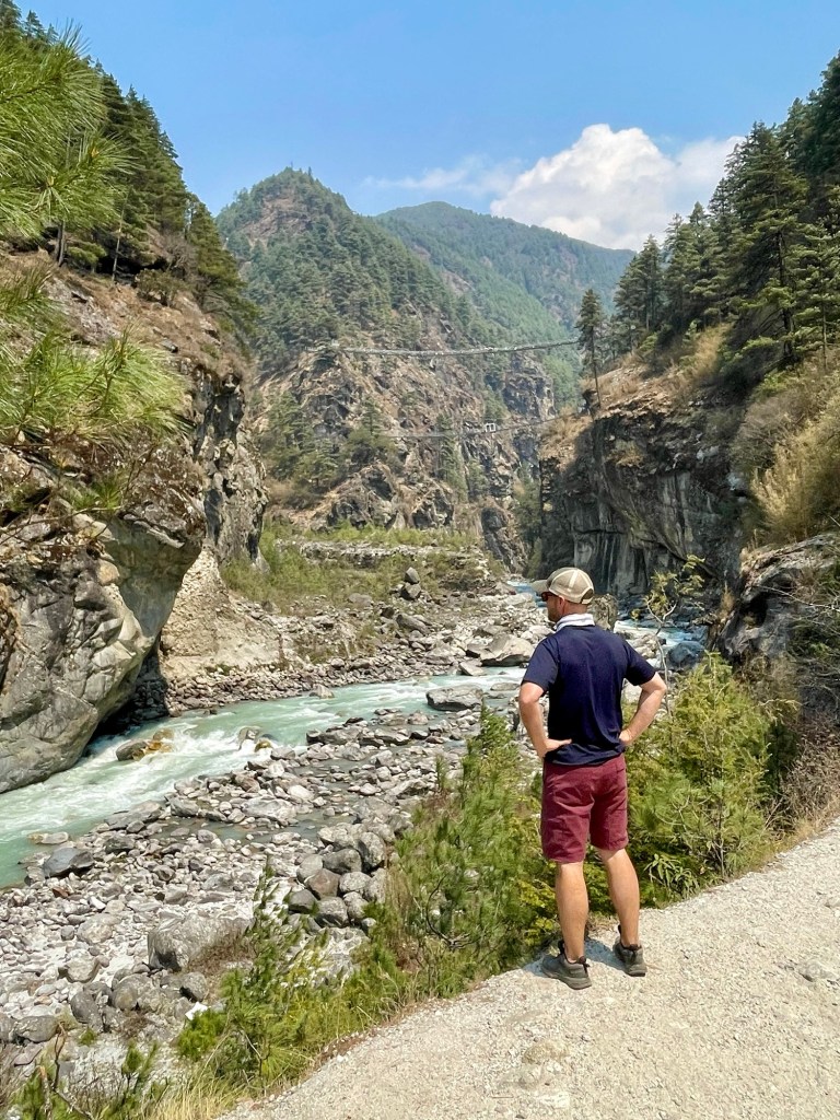
We hiked along narrow paths along a cliff was a blue river raging below us. We passed through many small Sherpa villages along the way including Thame, which is the birthplace of the famous Tenzing Norgay. There is a direct path from Thame into Tibet, which is the route the Sherpa people took when they moved west into this region several hundred years ago. We crossed over a huge bridge spanning a gorge and enjoyed watching ponies and yaks braving this suspension bridge as well. It was a small relief to arrive again back in Namche Bazaar, albeit on a different route, and to come full circle from where we were just eleven days prior. That evening we enjoyed our first real hot shower in nearly two weeks and indeed found those Guinnesses at the world’s highest Irish pub.
In Namche, we also met the Russian/Romanian expedition team. They were taking a break from base camp to get a shower, enjoy some hot food, and recover from the high altitudes. We asked them if they were excited to make the trip up the mountain and they seemed ready to go. Looking it up later online, they all made it to the top. We also saw that an ultra trail race was happening up in the region. A group of elite runners were starting from below our starting point of Lukla and running our whole route plus some in 5 days. Crazy!! We saw some of the runners going up.

Our final descent down the mountain was uneventful. We were able to enjoy our final bridge crossings, even meeting some puppies along the way. We took in the final spiritual sites and recognized our route since we had hiked up this same way. We did notice that there were very few people hiking up the other way which confused us until we finally reached Lukla.

Once we reached Lukla, we realized that getting down the mountain was going to be a problem since the weather had not been great the last couple of days. No planes had been able to come up or down the mountain. Therefore, in Lukla, we have found hikers that had been stranded there for days. It was not looking promising to be able to get on our flight the next day.
Yet, luck was on our side and the weather held out the next morning. After waiting several hours biting our fingernails in worry, we were able to catch a flight back to Kathmandu. This experience of hiking in the Everest region will stay with me forever. It was one of the hardest things I have done, but so rewarding. The views of the mountains here are unlike anywhere else I have seen in the world and I am so lucky that I got the opportunity to hike here.
Tips for hiking in Everest Region
- Get a porter and a guide – they are so helpful and it is so nice not to haul your own things or worry about the path or accommodation.
- If you are worried about altitude sickness, the drugs really do help and they are cheap to buy in Kathmandu.
- Bring water purification tablets to clean your drinking water instead of buying bottled water. It is much cheaper to just fill your bottle at the tea houses and it saves the environment. Tablets are again cheap in Kathmandu.
- Bring Tylenol – you will get a headache.
- Don’t forget to bring some cold medicine. Germs are easily spread and by the end, everyone has a cough. Sucking consistently on throat lozenges or having a buff over your mouth as you hike in the cold can help you avoid the Khumbu cough.
- Warm clothes are a must. If you don’t have any, you can rent them in Kathmandu.
- If you have more than 10 days, I highly recommend the three-pass trek. At the very least, do one pass and go to Gokyo Lake. It is amazing!
- Make sure to bring enough cash. Although meals were covered by our package, any extras such as drinks, showers, toilet paper, WiFi, etc all cost a lot more than you think they will. Additionally, make sure to bring enough cash to tip your guide and porter. There are ATMS in Namche Bazaar, but I have heard they are sometimes out of money.
- Pack light. Your Sherpa has to carry it all for you. Two hiking outfits plus one outfit for the evenings is plenty. A bar of soap is helpful to bring to wash clothes (mostly underwear, bras, and socks) along the way. Packing layers is a good idea since the temperature changes all the way up.
- Don’t forget your sunscreen, it’s easy to get burned at those altitudes.
- If you have a chance, try to do other hikes ahead of time to acclimatize. It was helpful for us.

Beautiful pictures and what an experience to go where most will never see. Thanks for sharing your trips with us!
LikeLike
What a beautiful story you have! Thank you once again for choosing Breakfree Adventures. We’re delighted to hear your wonderful experience and thrilled to be a part of your journey!
LikeLike