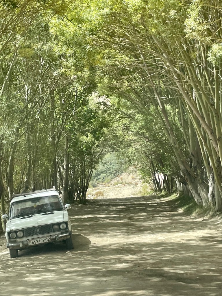
After two days of miraculously managing rides and shared taxis, which may have involved some impromptu hitchhiking on the side of the road, we landed in Osh, our final stop in Kyrgyzstan. The kindness we felt with the strangers that helped us make our way across the remote and mountainous Chinese border region created memories that will certainly stick with us, most notably the invitation into a local’s home to share some tea and homemade Manti (beef dumplings). We spent our last couple of days in Kyrgyzstan exploring Osh and picked up some supplies and necessary paperwork for our next major adventure which would take us across the southern Kyrgyz border on a nine-day trip along the famous Pamir Highway as we worked our way to the capital city Dushanbe, Tajikistan.

We were very lucky for the opportunity to travel the Pamirs at this particular time since the Kyrgyz Tajik border had been closed for the past three years due to COVID-19 and a recent flare-up in an ongoing border conflict between these two neighboring countries. The border had just reopened three weeks prior, and only for foreigners, which made things a bit trickier and more interesting. For this reason, we decided that it was in our best interest to hire a tour company that could coordinate the necessary permits along with private drivers instead of trying to attempt this on our own, which is our typical protocol. We used a tour operator named Visit Alay and found them to be extremely professional, and honest, and our drivers did a great job.

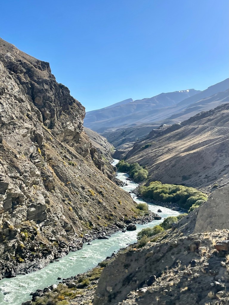
The Pamir region is an interesting area that stretches throughout the Southern region of Kyrgyzstan and into northeastern Tajikistan. The Pamir people are culturally different from the Tajik people and cherish their unique language, food, and customs. For this reason, we needed to secure additional paperwork prior to arrival that is referred to locally as a GBOA permit that allowed us to travel within this autonomous state in Tajikistan. Along the nearly 1,000 kilometers that we traveled, we passed many checkpoints where the military checked our permits and questioned our local driver before we could pass.

Day 1: Osh to Lenin Base Camp
Our first day on the Pamir was a long action-packed day. Our Kyrgyz driver picked up at 8:00 and we met another couple who would be sharing the trip with, Stijn and Marina from Belgium. We would spend many hours with them in the car and hiking throughout the next nine days. We first drove from Osh to Lenin Base Camp, which sits on the Kyrgyz/Tajik border. Lenin Peak is the second tallest mountain in Kyrgyzstan at 7,134 meters and is one of the easiest 7,000-meter peaks in the world to climb, but is certainly still a massive undertaking and we were not prepared to, nor had any plans on going to the summit. We finally arrived around 2pm at our yurt camp where we would be spending this first night.

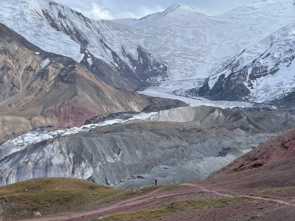
We then had the opportunity for a day hike up to a peak called Traveler’s Pass, which is the start of the Lenin Peak summit climb and provides a great high mountain view of the peak and the stunning glaciers that surround it. The trail we took led up to Camp 1, but we stopped a couple of kilometers shy. This path is full of spectacular alpine views in all directions, glaciers winding through the mountain passes, all the while having Peak Lenin tower over us. It was a five-hour return trip trek, so we had to move quickly in order to get back before dark.


The hike started out relatively flat with a river crossing to begin. Then, we started winding uphill through the valley and were finally greeted with a view of Mount Lenin. After turning into a side valley, we lost our view of the peak as we hiked further up the valley. The final push to the lookout is a steep switchback before reaching the summit of Traveler’s Pass at 4150 meters where you have a spectacular view down into one of the largest glacial basins flowing off the mountain. It was really windy at the top, but the views were extraordinary. Due to the late hour, we couldn’t stay long and hiked quickly back to the yurt camp finishing the last stretch with headlamps in the near dark. We were greeted with a terrific hot beef stew for dinner!
Day 2: Lenin Base Camp to Karakul (Kyzyl Art pass border crossing)
We had a leisurely wake-up at the yurt camp, and then hit the road bound for Tajikistan. After a bumpy ride, we arrived at the border to find it nearly deserted. As I mentioned before, it had only been reopened for three weeks at this point and only to foreigners. The Kyzyl Art Pass border crossing is unique because of how remote it is and it is one of the highest border crossings in the world. After stamping out of Kyrgyzstan, there is a 20-kilometer no man’s land in the high mountains of Kyzyl Art Pass, which tops out at a whopping 4,280 meters (14,042 feet).

Since our driver was not allowed to cross the border, we changed cars and drivers in this no man’s land between the borders. We were told that we were lucky that they allowed our driver to continue past the last Kyrgyz checkpoint and into this no man’s land with us. We were picked up by our Tajik driver at the summit of the pass in the middle of the no man’s land where one Kyrgyz and one Tajik military officer then escorted the drivers back to their respective border checkpoints. The Tajikistan border was much more relaxed and the border guards even joked around with us a bit.
From here, we drove several hours into Tajikistan until we reached our resting place for the evening in the small and extremely remote town of Karakul. The people in this town are a tough breed, and we found it very commendable that they make their homes and lives in such inhospitable conditions. This is the highest plateau in the world and the land does not seem very fertile, there is no food for livestock, and the giant lake Karakul is a saline lake and thus does not even provide a freshwater source. The town is covered in dust, and it was evident that the children had not bathed recently since most of their faces were quite covered in dust and dirt. The town sits at an altitude of 3,914 meters (12,841 feet) which makes it difficult to breathe at night and can give you a good headache if you don’t stay hydrated. For a reference on this altitude, the highest town in the United States is Leadville, Colorado which sits at an elevation of 10,151 feet.
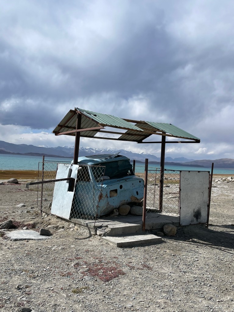


This said, the high alpine lake is very beautiful, and from Karakul, you enjoy a 360-degree backdrop of mountains in every direction. We were even able to see the Tajik side of Lenin Peak which marks the border with Kyrgyzstan in the distance. Once we had unpacked at the guest house and enjoyed lunch, we went on a walkabout along the lake and through the town to get a better feel for what it life in Karakul was all about. Everyone we came across was very friendly, and the kids were so curious! Before dinner, the dirt streets were filled with groups of kids hanging out, but very few adults were seen.


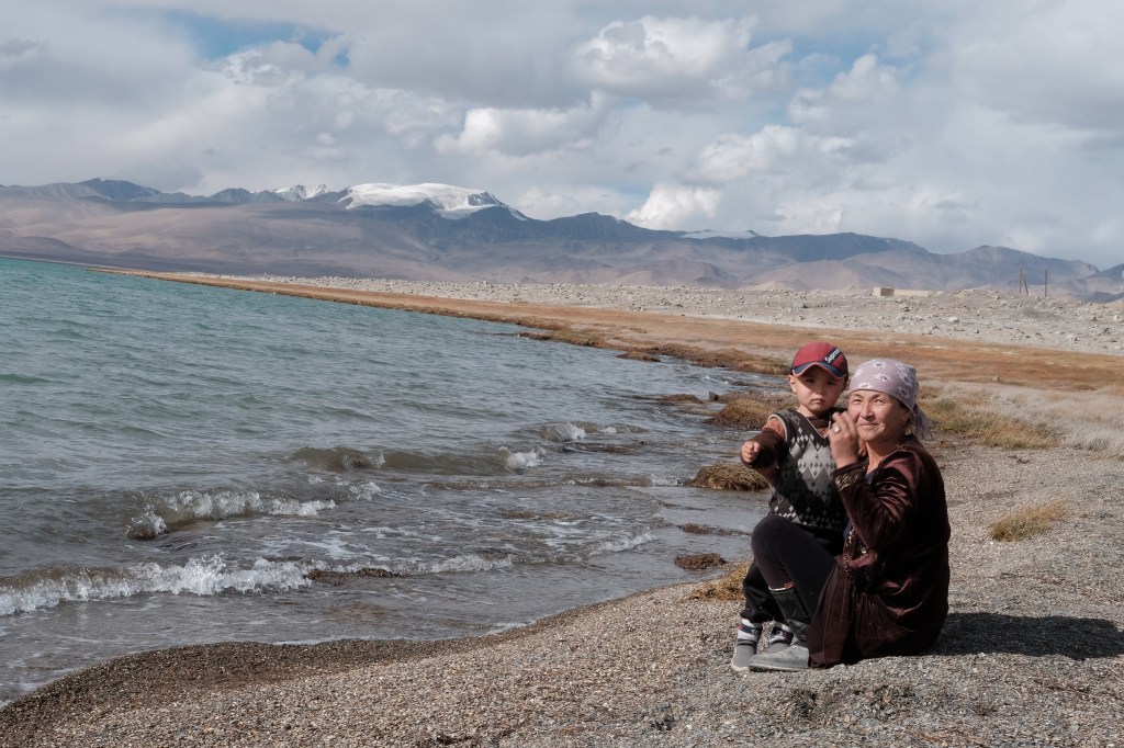
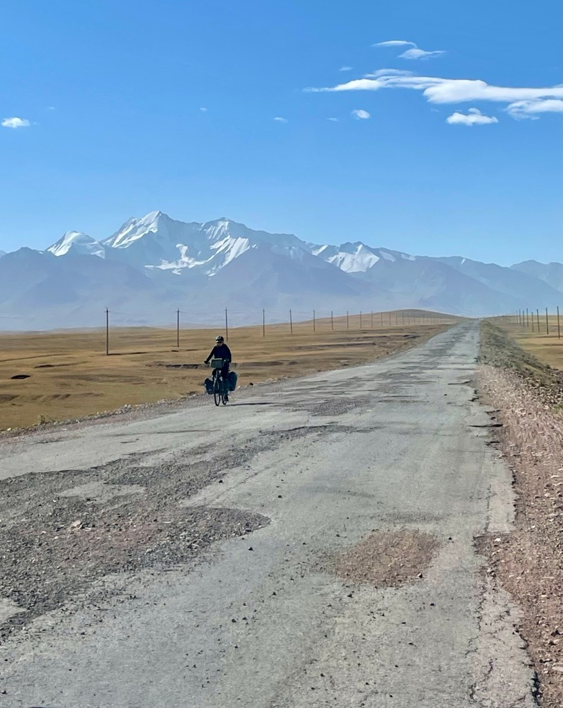
We did notice that the main source of fresh water came from a well with a hand pump in the center of town. We had a lovely dinner that consisted of, you guessed it, beef stew, which we quickly learned is the signature food in this region. The two young daughters at our homestay even put on some fancy homemade dresses and danced for us during dinner. It was a cozy place to spend the night, and our guesthouse was full of foreign travelers. We met some bike packers, which is a popular way to travel the Pamirs as well. I give them so much credit because riding long distances over these mountain passes at such high altitudes certainly cannot be easy.
Day 3: Karakol to Alichur
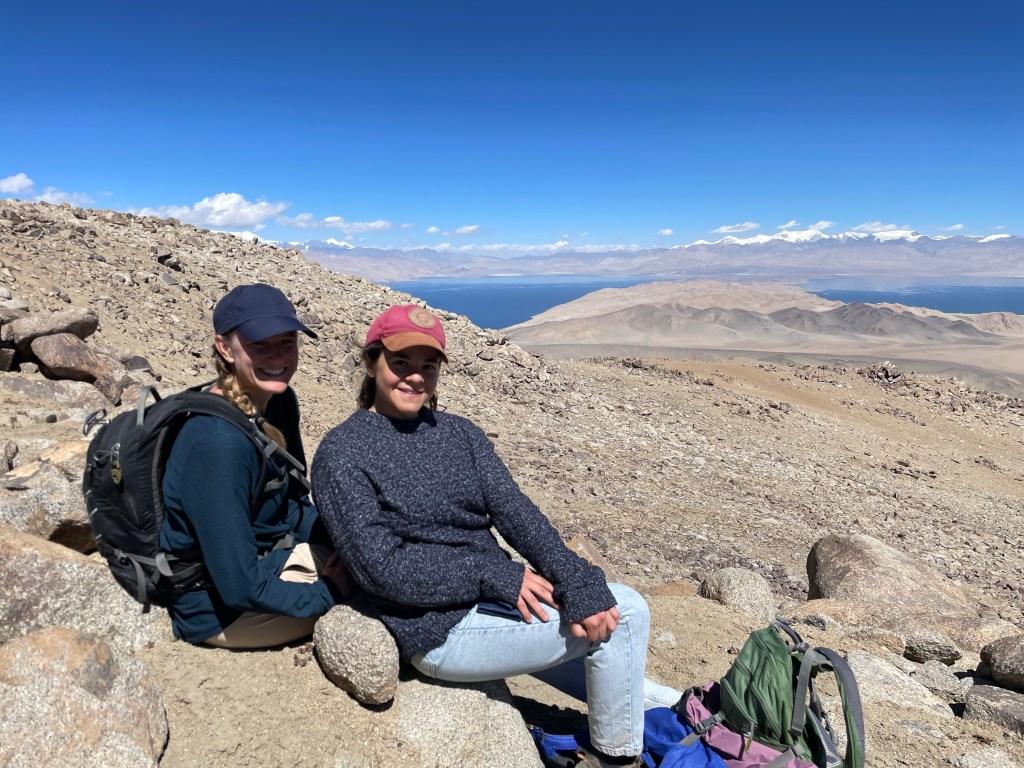
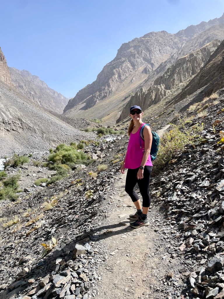
The third day of our Pamir trip was exciting. The hike that our driver arranged for us was not part of the original itinerary, but I think that our driver Uhmed added the hike since Nate asked about it the night before. We woke up early and drove for around 45 minutes before arriving at the base of a mountain overlooking the lake. Uhmed told us that we would be hiking to 5,000 meters and it would take us seven hours for the return trip, but the hike didn’t really seem that long on the map so we didn’t fully believe him.
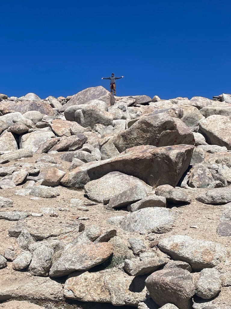
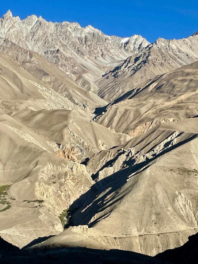
Most of the hikes that we did on this trip were not marked trail hikes, but instead, we were given GPS of the hikes that we needed to follow. At these high altitudes everything is rock and trails are not clear. Very early in this hike, we got off track and when trying to correct, we just made it worse. This led us to take a steeper route instead of the more gradual route. In addition, the hike toyed with us because several times we climbed up thinking the summit lay just ahead, only to see another hill we still needed to climb. The high altitude was not easy, and it was slow going, particularly toward the summit, as we found it very difficult to catch our breath. Regardless of the difficulty, as we continued to look back, the views of Lake Karakul became better and better as we continued to gain altitude.

One of the noticeable absences on the Pamir highway is the lack of any wildlife. Gone are the herds of sheep, goats, cows, yaks, and horses since there is nothing for them to eat in the barren landscape of this high mountain plateau. The only wildlife we saw were rabbits jumping from hole to hole. We were also rewarded with a few rare sightings of antelope in the distance high up on this trek. Throughout the hike, we saw bighorn sheep antlers and heads, but never saw one alive.

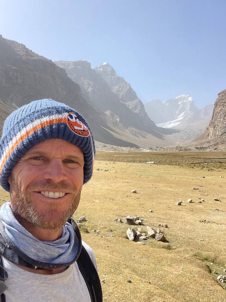
When we finally reached the top of our hike I was relieved and proud of myself. We made it up to 5,070 meters (16,610 feet). This is the highest I have ever been in my life, and hopefully good training for the Everest Base Camp trek which will take us to over 5,300 meters. Once at the summit, we had 360-degree mountain views that surrounded us. To the north is Mount Lenin on the Kyrgyz border, to the east is the Tain Shan mountain range stretching out of China, to the south is the massive peaks of the the Hindu Kush range in Afghanistan, and to the west is the stunning and rugged Pamir range in Tajikistan. We were surrounded by some of the highest mountains in the world!

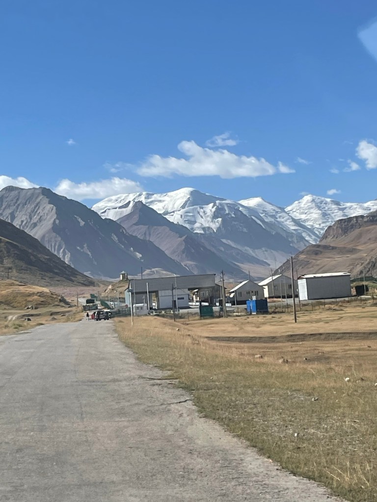
Following the GPS map down, we discovered where we lost the GPS tracking in our ascent, and the route down was subsequently less steep. All in all, our driver Uhmed was correct as the return trip took us around seven hours, and by the end, we were very tired when we returned to the car. From here, we drove south on the Pamir Highway over the second-highest highway pass in the world, and then on to the biggest town in this northern Pamir region named Murghab. We were expecting more than Murghab turned out to offer, but this is a terribly difficult place to live so we really should not have expected much. The town is a larger version of Karakul, and with all due respect, a bit of a shanty town. We saw that many houses were made out of old Chinese shipping containers. The only Tajik border crossing with China is nearby, and most likely provides the main source of work for the residents of Murghab.

Our driver did not want to stay the night in Murghab, so even though we arrived at dusk, the plan was to continue driving for a few hours further down the highway. Our main goal in Murghab was to exchange for Tajik currency. Since the border had been closed for nearly three years, we were not able to find any Tajik Somani to exchange for back in Osh before crossing the border. Therefore, we needed to find an ATM. Unfortunately, this region is incredibly remote, ATM’s are not easy to come by, and even if you do find one they often are not replenished with cash to provide. Furthermore, we arrived in Murghab on a Sunday, and the banks in town were closed. Luckily, our driver Uhmed travels the Pamir regularly, has many friends along the route, and turned out to be very savvy. After driving around town and calling on his friends, we pulled into the biggest grocer in town (not big) and exchanged our crisp 100 USD bills for all the Tajik money in their cash register. Our final stop for the night was a tiny town named Alichur at a really wonderful homestay. Our host waited up for us to arrive just after 9 p.m., and had a terrific beef stew dinner prepared when we arrived. We were ravenous after our long day! We were also excited at the news that we were able to have our first hot shower since leaving Osh several days earlier. The water was heated using an innovative pipe system running off the back of the cooking stove in the room next door, which allowed for a hot bucket shower before bed. On this cold evening and after three days of big trekking and travel, I would have taken anything.

Day 4: Alichur to Langar
The next morning we had another early start, and we were on our way further along the Pamir. Our first stop was a quick visit to Lake Yashikul. To get here we needed to do some off-roading through the desert. I felt like we were straight out of Mad Max as our car screamed across the sand. We were rewarded with a beautiful freshwater lake view at the top.


Once back in the car, we wasted no time as we quickly moved on to our next stop. This was a loop trail hike to Hausibek’s Viewpoint. Both Nate and I were not feeling our best that day with some stomach problems, so the hike was a bit slower going than normal. We were also still tired from the day before and after four days at 4,000+ meters, our bodies were starting to feel the effects. Nevertheless, we made it up this mountain trek and were rewarded with our clearest views yet of the Afghan Hindu Kush mountain range. Behind us were two beautiful Alpine lakes, one was fresh glacial water emitting a bright Caribbean blue while the other was a saltwater lake and much darker in color.

We enjoyed the views of the Afghan mountains and hid from the intense winds while enjoying a quick snack behind a manmade rock-walled shelter at the summit. After this, we began our trek down along the ridge and down the mountain. Again, this was not a maintained or clear trail, so it was more of a trailblazing exercise of simply finding our own way down the mountain and hoping not to slip on the loose gravel. At points, it was fun slipping and sliding, while at other points it was slightly scary.


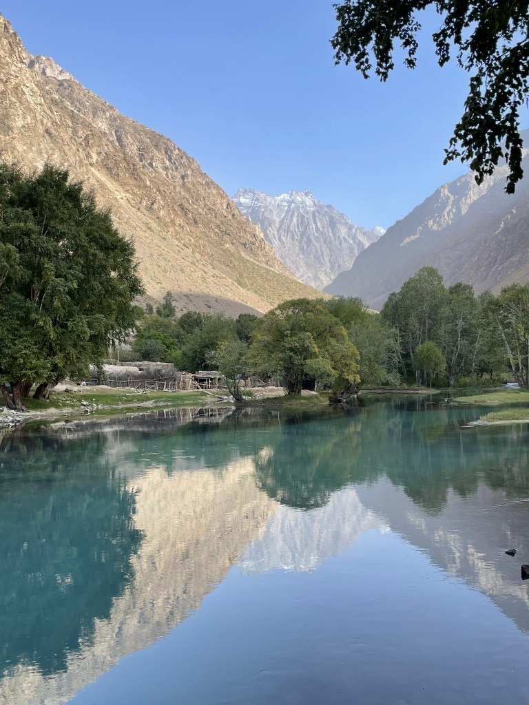
Once down, we continued on our way down off the high plateau and on to our final stop for the day, the beautiful and lush valley town of Langar. To get here we connected with and drove along the Panj River, which defines the border between Afghanistan and Tajikistan. The road here was crazy for two reasons. First, we could see across the river into small Afghan towns. It was literally a stone’s throw away from where we stood. I can attest to this because Nate decided to throw a stone across the river to see if he could land it in Afghanistan. Second, the road was carved into the side of a cliff. On both sides of the river, the mountains rose incredibly steeply around us and we were on a narrow road of mud that felt like it could collapse into the river below at any point. There was one particularly scary moment when we had to cross a tributary creek running into the larger river and unfortunately, the bridge over the creek had apparently been washed out in the spring. We got stuck crossing a makeshift bridge that was also washed out and it took a couple of tries to successfully cross.
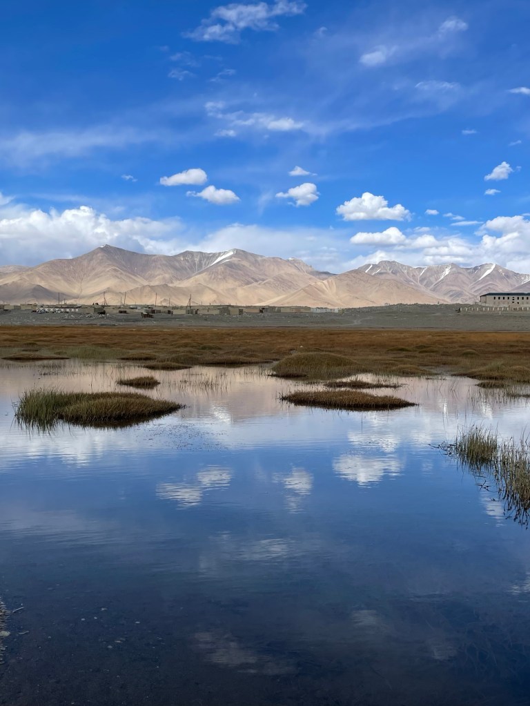
What surprised us most about the drive into Langar was the first green we had seen in many days. Langar is located in a lush valley and is full of agriculture and trees. Everyone living here farms their land, and it was in our opinion the nicest town that we traveled through thus far on our Pamir Highway adventure. Our guesthouse was set amongst beautiful scenery, however, it was evident all of their water came directly from the river. All water in the pipes came out brown and we were worried about the cleanliness of our food preparation.

Day 5: Trek to Engel’s Peak Viewpoint
When traveling for extended periods there are going to be those unfortunate days when a stomach bug or flu hit you. I had been a bit under the weather for the past several days and something in the food, or in the water used to clean plates and cutlery really hit me hard when I woke up this morning. I was very disappointed because the hike to Engel’s Peak is one of the most highly anticipated, and we were now off the high plateau, so the altitude would not be as difficult to deal with.
Unfortunately, Nate and our Belgian friends would have to leave me behind for this trek as I knew I needed a day of rest in bed to have any chance of getting back on the road the following day. Nate has graciously accepted the role of guest writer to detail Engel’s Peak Viewpoint trek.
Nate: It was an uneasy and slightly somber feeling leaving the guesthouse without Teri this morning. She was really struggling with a bad case of the flu, yet she insisted that we carry on without her. It certainly would not be the best hike without her, but there was little I could do for her other than let her rest, so I departed the guesthouse with our two Belgian traveling friends and we set off to reach the infamous Engel’s Peak viewpoint.

This hike has two possible starting points, and based on the maps we had, these two routes merge approximately halfway to the top. One trail is much shorter in length and very steep, while the other trail is much more gradual, but several kilometers longer. Full of confidence after reaching 5100 meters a few days earlier, we chose the short and steep trail, which departs right from the heart of the Langar village. This was a bit of a regrettable decision as this trail turned out to not be much of a trail at all, and steep turned into very steep. There was a lot of vertical trailblazing and rock climbing involved, and our Belgian friends quickly found themselves overwhelmed and quite stressed. After several hours of very difficult climbing they decided it would be best for them to turn around and return back to the guesthouse as soon as they reached the midpoint where the two trails merged. They were quite relieved to reach the midpoint and happily took the long and gradual trail back, which I agreed was a safer option. However, I was determined to carry on to the top of the trail to see the famous viewpoint of Engel’s Peak before starting the descent. The second half of the hike up was a much more established trail, and far more enjoyable. The upper half of the hike followed a manmade aqua-duct that fed out of a larger creek from which it was pulling water. Further up the valley, this larger creek flowed out of a small natural lake at the top of the trail, which provided a beautiful view up the valley at the venerable Engels above.

We woke up earlier this morning to skies that were filled with dust, which we later found out was a fairly regular occurrence due to dry dust storms that blow in and up the valley from Afghanistan. As a result, this day’s views of both Engel’s Peak, as well as at the Hindu Kush range back down the valley were not framed by the clear blue skies that we were lucky enough to have over the past several days of our trekking in the Pamirs.
The Engel’s Peak trek is over twenty kilometers in total and was made even longer when I chose the safer and more gradual route down. I was accompanied nearly the entire descent by a lovely little dog that I met at the top, and we came across several sheep herders near the bottom of the trail back down to the Wakhan Valley floor. Since I took the longer route back, I did not reach the guesthouse until nightfall and I was eager to check up on Teri to see if she was feeling better. Sadly, she had not been able to get out of bed all day, and her stomach was still in no shape for dinner that evening. All we could do was hope that another night’s rest would allow her to manage tomorrow’s long travel day and the historical sites that we had on the itinerary.

Day 6: Langar to Khorog
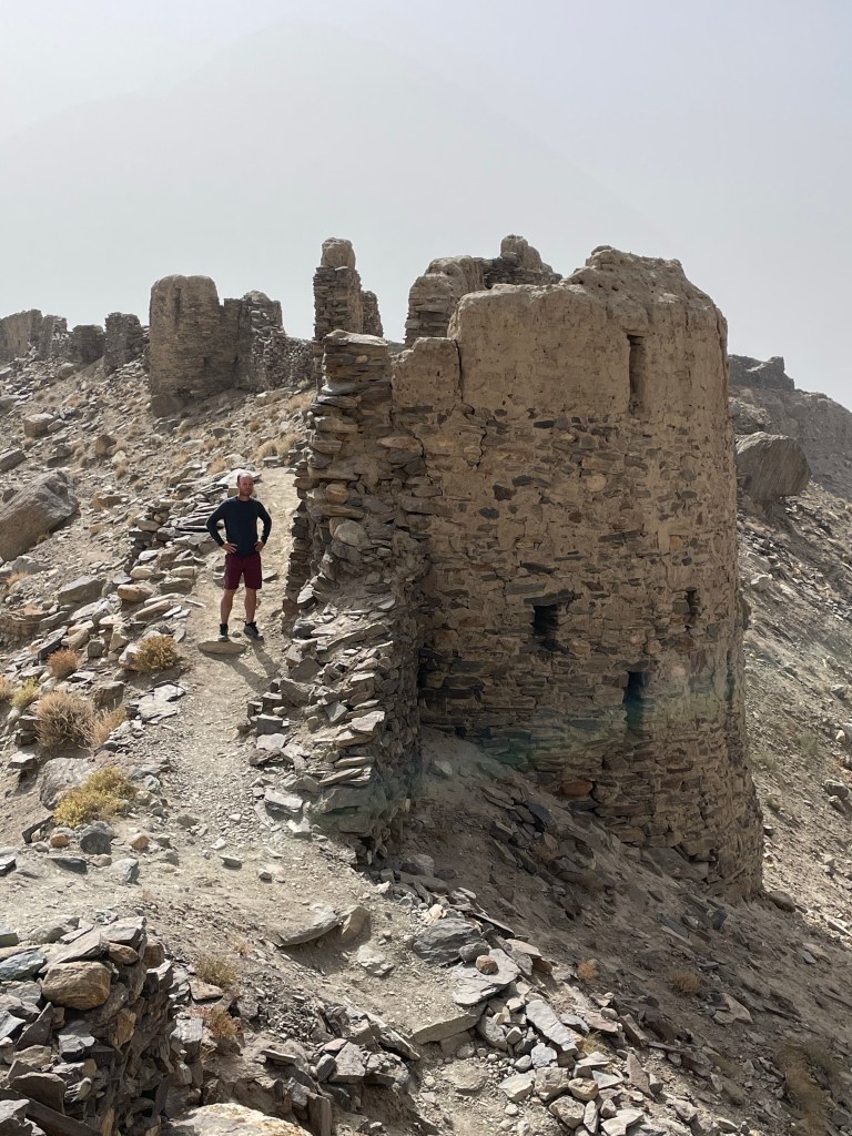
I awoke the next morning feeling better than the day prior, yet still not great and I was very weak after not eating for over 24 hours. Our first stop was Yamchun Fort, which is located several kilometers up a steep side road and overlooks the Panj River below. We did not have a whole lot of information about the fort since there was no information posted either outside or inside the fort, and we were not able to connect to the internet at all during our time in the Pamir region. Our driver Uhmed was amazing with managing the crazy mountain roads, as well as the logistics of our travel, however, his English was not great and he was not able to provide much insight about the origins of this particular fort. It is an interesting rock structure high up on the hill, and we could see the remains of tall walls with window slits that must have been used as lookouts and possibly defensive shooting. The fort is strategically placed high up on the mountain slope looking over the valley, which would leave any invading force at a distinct disadvantage.
Our second stop was just a bit further up this same steep road to a natural thermal bath and hot spring. With little information to go with, Uhmed parked the SUV and pointed us up a path in the direction of a small building where a nice local lady who managed the springs told us that the men and women would be separated. We waited for the group ahead of us to empty the hot spring, and then we were allowed into a ladies’ changing room. The group was a mixture of several tourists along with some locals. I followed the group and completely undressed. I had brought a bathing suit, but it seemed that it was not needed. On the men’s side Nate later told me that they did wear their bathing suits.
The hot springs, while seemingly indoors with a roof, are in fact a cave or grotto-like structure. The walls are stone with water dripping down the moss-covered rocks. There is a lovely natural waterfall inside as well. It is not very big, but the water is very hot, and it feels like an oasis amongst these harsh mountain conditions. For obvious reasons, I do not have any photographs, but I can assure you it is a beautiful natural bath in the Tajik mountains. Fifteen minutes was all that we could manage with the hot water, and when the local women began to get out we took that as a sign that we should as well. It turned out that I needed to get out because due to the heat and lack of food over the past several days, I nearly passed out while getting redressed.

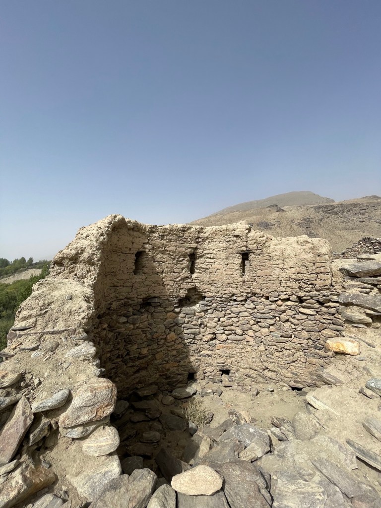
Our final stop for the day was another historical fort. This second site was just off the main road, and busier than the one we visited earlier in the day. On the day we visited there was a local merchant selling his handmade souvenirs by the front entrance, which was the only time we saw a local artisan craft in the Pamir region, a reminder of how remote and unvisited by tourists this region is. Once again, no information about the history of this fort is provided, but the walls of the fort and the paths to see it are in good shape. One of my favorite aspects here is that we could see local Afghan farmers across the river on the Afghanistan side of the border clearly from the lookout points. If we didn’t know the other side of the river was a different country, we would have never guessed due to the similarities in the farms and houses on both sides.


That evening, we arrived in Khorog, which is the capital and largest town of the Pamir region. This city provides a stark contrast to the poverty and the simplicity of the towns we visited thus far in Tajikistan. Throughout our journey, it seemed that as we came down from the high plateau in the far northeast, every town we reached next was more developed and had better infrastructure than the last, and in our opinion, Khorog might perhaps be the nicest town in all of Tajikistan. There is a beautiful park in the middle of the city, and the streets are remarkably nice and well-paved, particularly compared to where we had just come from. Our guesthouse for the evening was beautiful, and we were excited for western rooms with full bathrooms and showers for the first time on the trip. That night, after nearly one full week of beef stew and bread, we ventured out and found a rooftop restaurant where we enjoyed pizza and beer. It was a well-needed meal!

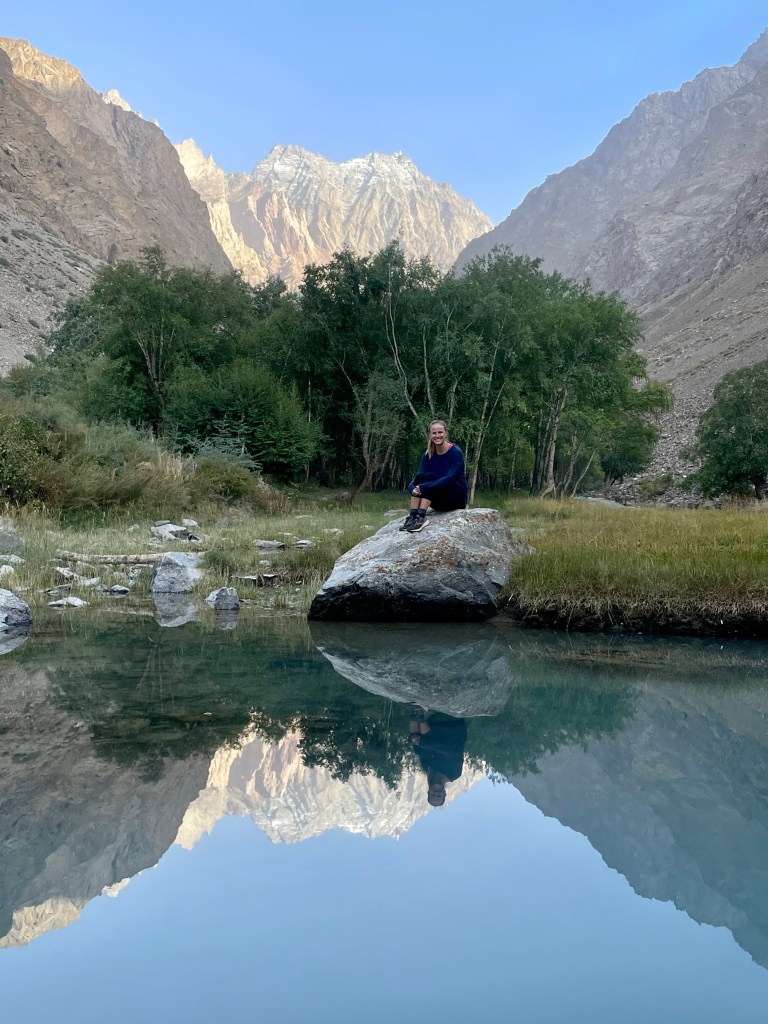
Day 7: Khorog to Bartang Valley
Leaving the comfort of Khorog, we picked up some water and snacks and headed out early on our way to the picturesque Bartang Valley. It is hard to describe the beauty and the peacefulness of the Bartang Valley. Our driver drove us up the valley a bit, and then pulled over on the side of the enormous river to let us unload and begin our trek by crossing a spectacular suspension bridge. Once across the main river, we were instructed to hike two hours up a tributary canyon by following a decent-sized creek until we arrived in a “village”. It was arranged for us to spend the night at a homestay in this village, and then hike back in the morning to reunite with our driver and continue the drive down the Pamir highway.

After crossing the large river we quickly turned the corner and hiked up the side canyon. The walls on both sides were about fifty degrees of loose rock scree that I worried could fall down and start a rock slide. We followed a small river up the canyon and I was surprised by how green and lush the valley was. The Bartang Valley sits at a much lower elevation than we had been hiking and the creek is lined with trees and grass, and as we approached the small village you could see the locals have planted a large variety of different crops.

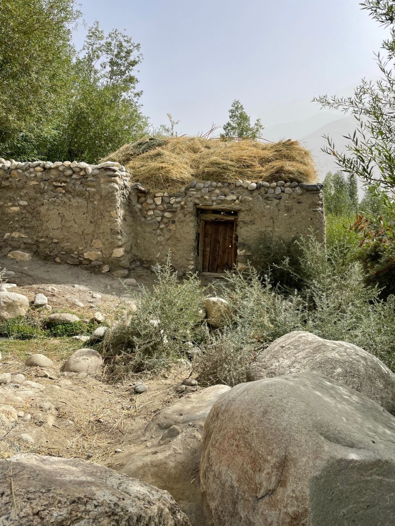
After two hours, we arrived and were greeted by our host family with sweets, tea, bread, and homemade jam. We learned that there are several families that live up in the valley, and they have divided up each family’s properties by the lakes that go up the valley. These families have lived here for generations! Any time they want to leave and get supplies they must make the two-hour trek down to the road and catch a ride from there. They do not own or use any motorized transportation. Our host said he frequently uses his donkey to get more supplies up the valley.

He also said there are two teachers among the families, and all of the children go to school. Additionally, the villages collectively own some goats and cows and take turns looking after the animals and collectively share the meat and milk. Since there are no refrigerators, the villagers only eat vegetables and grains in the summer months since the meat would spoil. In the late fall and winter, they will slaughter a few animals since the freezing temperatures provide natural refrigeration.

We hiked further up the valley and passed three other beautiful lakes, and were able to say hello to the other families who lived and worked the land near these lakes. Everyone in the valley was very friendly offering us fruit and tea. Very few tourists had been up the valley for several years due to Covid, and for this reason, I believe the kids were extra excited to talk to us and test the English they learned in their schooling.


We took many pictures and also took an opportunity to relax and read by the lakes. It was truly remarkable and good for the soul to slow down and experience this incredibly slow pace of life, and to see how tranquil and happy these families are living off the modern grid in the Bartang Valley. Life would be hard, but they seemed to revel in the peacefulness of their existence. This is a very difficult existence, but rather than missing out on the eases of modern life perhaps they have something better in the deep connection they have with each other and nature.

For dinner, we had vegetable noodle soup, and homemade bread straight from their open-fire oven, which was delicious! We enjoyed talking with our host since he spoke English quite well, and he shared that his brothers and their families had left the valley to work in Moscow where they had the opportunity to earn more money. We spent the night sleeping on raised platforms covered in many handmade wool blankets in a large room that could easily fit ten people. Our hosts helped lay out futon-like mattresses and several thick blankets to sleep on and it was surprisingly cozy.

Day 8: Bartang Valley to Qal’ai Khumb
We woke early to begin our hike out of the valley since we were about to reach the stretch of the Pamir Highway that has been under construction for over five years already as part of the Chinese Belt and Road initiative. We came to quickly feel every Tajik’s frustration as we learned that they had ripped up many kilometers of the road instead of completing a small section at a time. In addition, the road is completely closed for most of the day. If you want to get through during the day you must be to the start of the construction when they open it for the brief hour during their lunch break between 11:30 and 12:30 each day. If you enter the road between this time, you can get through, however, if you miss this lunch break you have to wait until 5:00. It was a nice reminder that we are not in a democratic country, and they didn’t hire a democratic nationalized construction company.
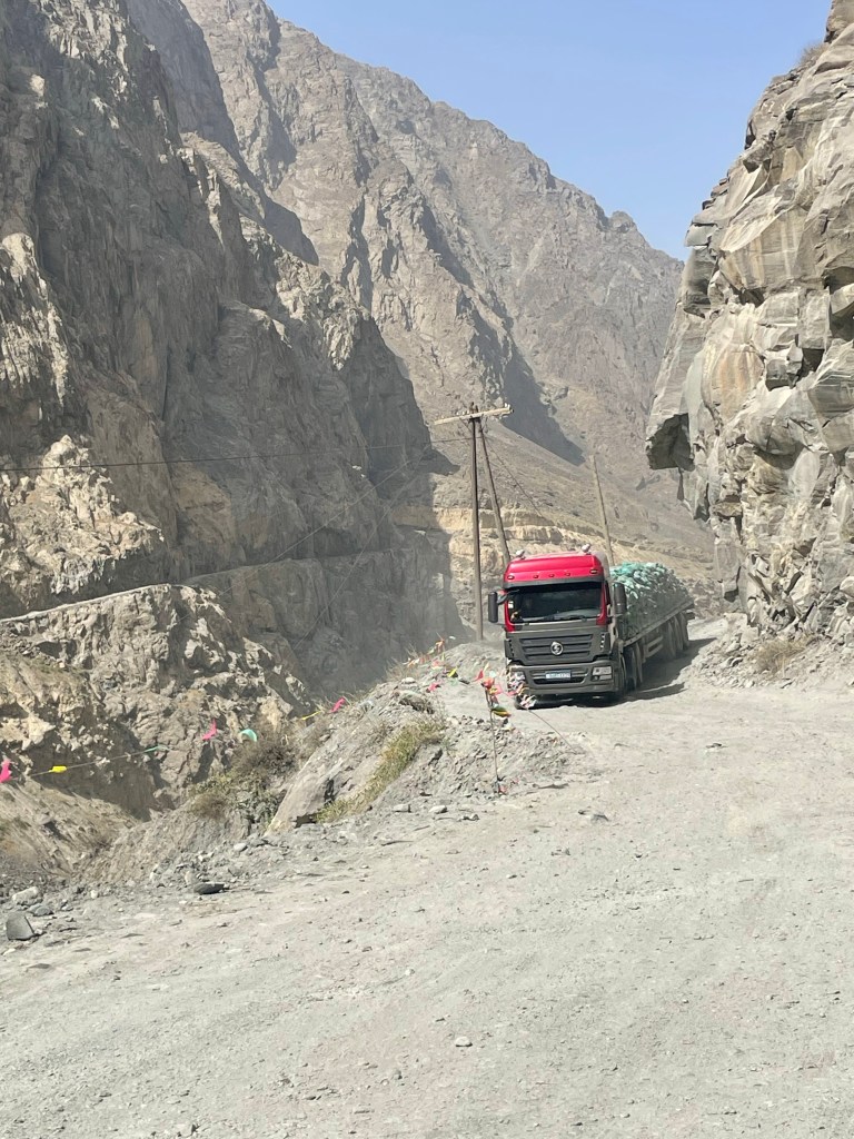
Luckily, our driver Uhmed timed our drive perfectly and they opened the road right as we arrived. From here we began what turned out to be the worst day of driving on the Pamir Highway. The road was a disaster, and we were bumped around in every possible way. Additionally, it was quite hot and we could not roll down the windows or else we got a face full of dust. We were constantly pulling over on temporary one-lane stretches of road, and having to reverse to let tractor-trailer trucks pass by. The whole experience lasted several hours, and when we finally made it through the eighty kilometers of road construction we were all quite relieved.

We arrived in Qal’ai Khumb in the early afternoon and quickly found a cute little restaurant to eat. We were all very hungry and enjoyed a nice lunch at a riverside restaurant where we shared plov, salad, and cold beers. It was a perfect way to relax after a bumpy day. We walked around town and took in what we believe a typical Tajik town looks and feels like. In this town, they had just built a new school and it looked really nice. As we strolled by the school we talked briefly with some of the students, and watched them play soccer on their new artificial turf Futbol pitch.
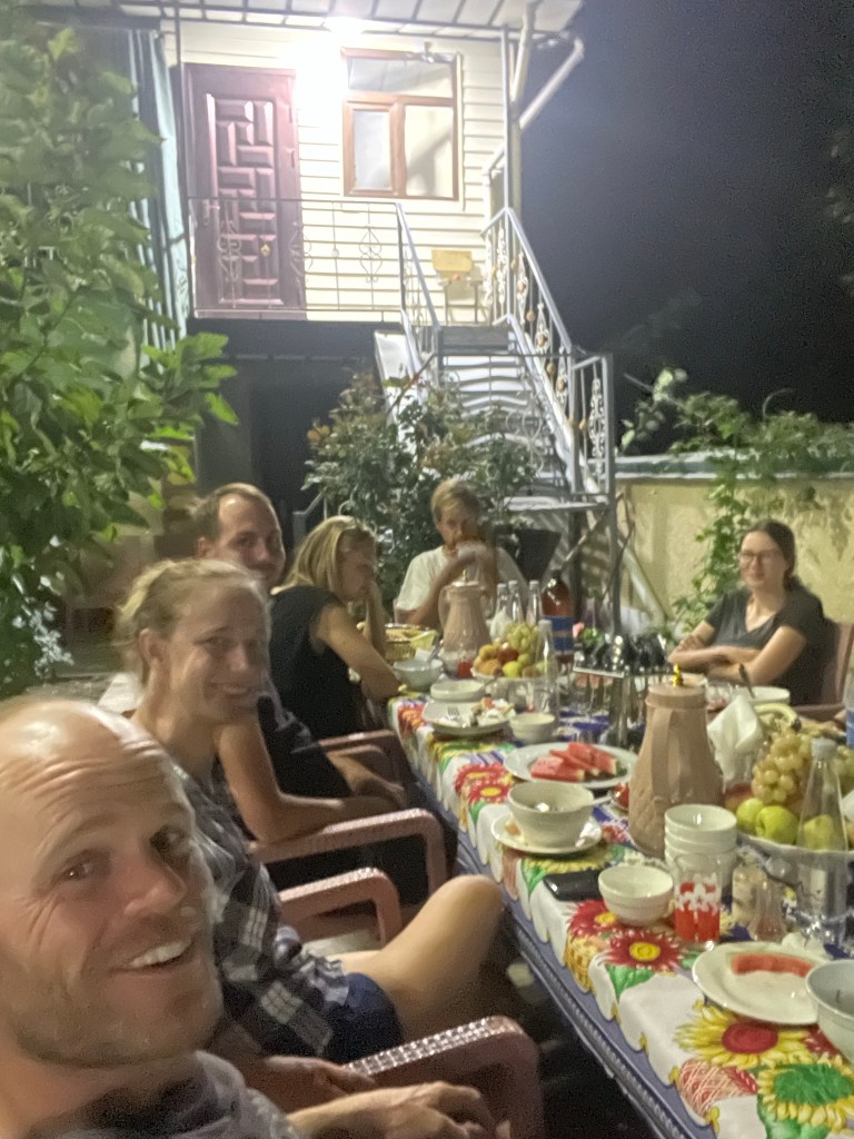
For dinner that evening, our guesthouse put out a nice spread of food and had a beautiful outside table arranged for our group of eight. We were joined by four others from a separate tour with the same company whom we had been constantly reconnecting with throughout our journey. It was a nice way to spend our last night on the Pamir Highway.

Day 9: Qal’ai Khumb to Dushanbe
Our final day on the Pamir Highway was rather uneventful. The road from Qal’ai Khumb to Dushanbe was finally a nice paved road and we made tremendous time compared to the previous day. It was a long seven-hour drive into the capital city to finish our journey, but after the rough day before we found it very relaxing and just took in the flatter landscape and farms that came with it.
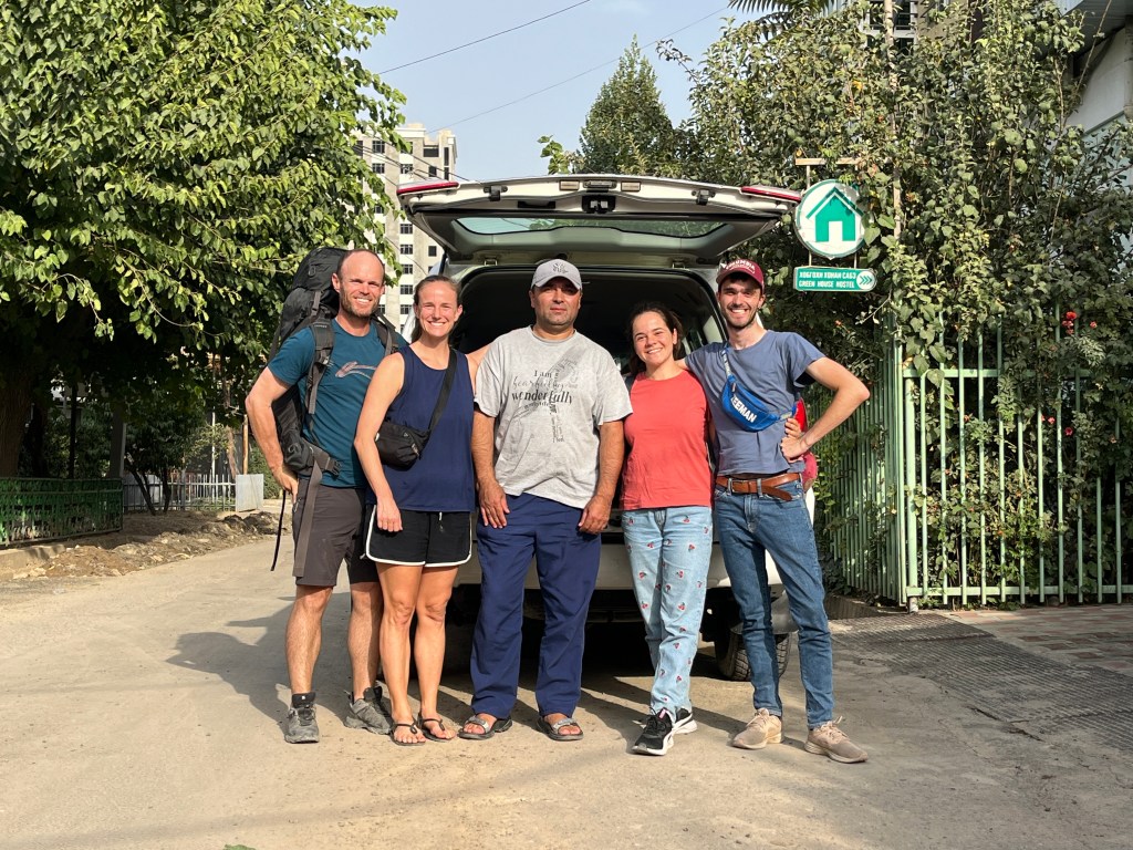
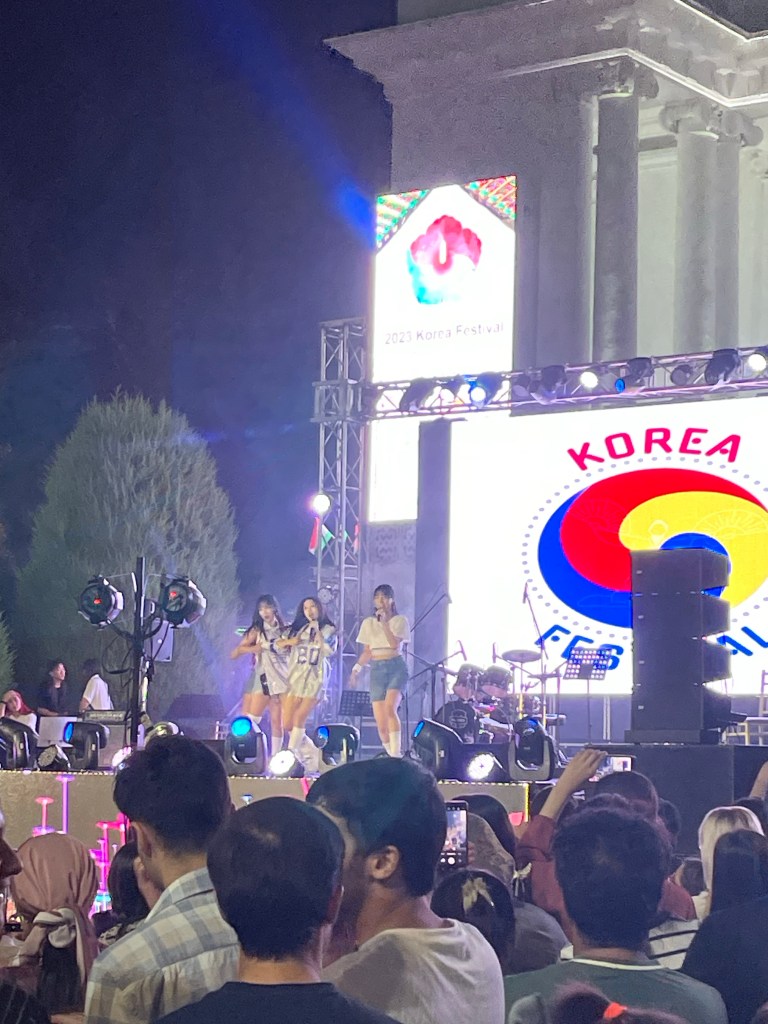
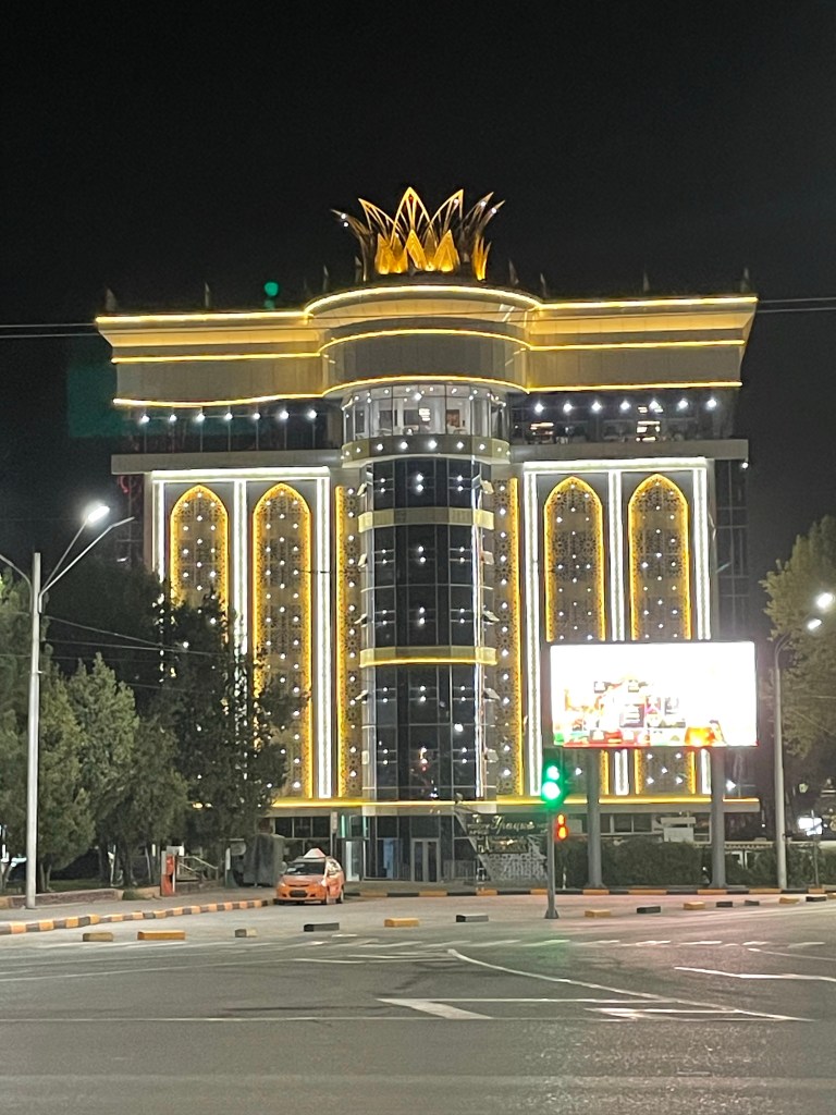
Once we arrived in Dushanbe, which is the capital and largest city in Tajikistan, we again found it to be much more modern than anticipated. We stayed at a nice guest house called the Green House Hostel, and it was terrific to have a modern room to ourselves with an en-suite bathroom. In need of something different, went out for dinner at an Indian restaurant that evening, and along the way, we randomly came across a Korean festival that was organized by the local Korean embassy. There were booths selling food, women dressed in traditional hanboks, and a K-pop girl’s group performed. After living in Korea this was an interesting reminder of fond memories from our time there and it was nice to see that Korea is trying to spread its culture around the world.
Dushanbe has a distinct ex-Soviet state feel, yet it is clear the leadership wants it to be a showcase for the country’s progress, and it has developed a unique vibrance and life at night with people out and about and so many lights. One major pedestrian street we came across had a center sidewalk that is just a walkway of arches of lights for almost a kilometer. Another street in the city has the feel of Vegas with a long stretch of brand new mid-rise buildings that are nearly a carbon copy of one another and lit up brightly like the Vegas Strip.
The following day we took advantage of the internet since we had been offline for the past nine days. We sorted our emails and some logistics with travel and life back home and found time for a walk around the parks of Dushanbe. For dinner that evening we found perhaps one of the best foods in Tajikistan called Qurutob. It is apparently the poor man’s food in this country, but I wish we had more of it in our time here. Qurutob is served in a wooden bowl which grows depending on the number of people in your group and subsequent portions that you want. This is a dish that is meant to be shared. The bottom is bread and on top is yogurt, vegetables, salad, and meat. The bread is soft and soaks up everything. Yum!!


What a wonderful adventure you had
there! And you accomplished some
amazing challenging hikes! You are
both making such incredibile
memories together. Thanks foe
sharing your travels with us!
Sue Barnes
LikeLike